St. Andrews in Charlotte County, New Brunswick — The Atlantic Provinces (North America)
War of 1812: Defending St. Andrews
Guerre de 1812: La defense de St. Andrews
Inscription.
English on left
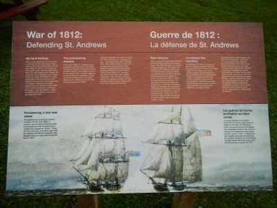
No hard feelings
Have a look across the St. Croix River to the land on the other side of Navy Island; that’s the United States you can see! When the War of 1812 broke out, the citizen of St. Andrews had little to fear from their neighbors in Maine. Not everyone in New England was in favor of the war: trade with Atlantic Canada was brisk and around here the main threat to security was from privateering, not invasion. Despite the conflict, resolutions were passed on both sides of the border declaring a local truce, although in 1814 the British in Halifax invaded Northern Maine, which they occupied until 1818.
The privateering menace
In the early 1800’s, St. Andrews was a prosperous garrison town with a busy commercial seaport. Licensed American privateers would undoubtedly be drawn to the ships for their valuable cargoes or loot homes and businesses. During the American Revolution, privateers attacked and robbed every port in the Maritimes except for Halifax.
Three gun batteries were quickly erected and three blockhouses - including this one - were added soon after to defend them. From inside, soldiers armed with muskets and a small cannon could defend the batteries and help protect shipping along the river and harbour. These 18-pounder guns - so called because the shot they fired weighed 18 pounds - could fire as far as Navy Island. The defenses worked. Although privateers captured many ships at sea, they never attached St. Andrews.
Privateering: a two-way street
Privateering was a common wartime practice until the mid-1800s. In wartime, governments licensed private businesses and ships to seize enemy vessels and cargoes as “prizes.” These (for the most part) completely legal raids by American and British privateers were frequent along the east coast during the War of 1812.
French on right
Sans rancune
Jetez un coup d’oeil de l’autre côté de la rivière Ste. Croix, au-delà de l’ile Navy: ce sont les États-Unis que vous voyez! Lorsque la guerre de 1812 éclata, les citoyens de St. Andrews avaient peu à craindre de leurs voisins du Maine. Les citoyens de la Nouvelle Angleterre n’étaient pas tous favorables à la guerre: le commerce avec la région de l'Atlantique était florissant, et la population redoutait devante les corsaires qu’un éventuel envahisseur. Malgré les hostilities, des résolutions furent adoptées de part et d’autre de la frontière pour déclarer un trêve à l’échelle locale, même si, en 1814, les Britanniques d’Halifax envahirent le Nord du Maine, qu’ils occupèrent jusqu’un 1818.
Le menace des corsaires
Au début du 19ᵉ siècle, St.
Andrews était un village de garnison prospère, et son port de mer commercial fourmillait d’activité. Il ne faisait aucun doute que les corsaires sanctionnés par le gouvernement américain chercheraient à saisir la précieuse cargaison des navires ou a piller les demeures et les entreprises. Pendant la guerre de l’Indépendance, les corsaires avaient attaqué et pillé tous les ports de Maritimes, sauf celui d’Halifax.
Trois batteries de tir furent érigées à la hâte, et trois blockhaus - dont celui-ici - furent construits peu après en guise de protection. De l’intérieur, les soldats armés de fusils et d’un petit canon pouvaient défendre les batteries et contribuer a protéger les navires marchands qui circulaient sur la rivière dans le port. Le canon de 18 livres - appelé ainsi parce que le boulet pesait 18 livres - pouvait atteindre des cibles aussi éloignées que l’ile Navy. Les ouvrages de défense produisirent les résultats souhaites. Les corsaires capturèrent de nombreux navires en mer, mais jamais ils n’attaquèrent St. Andrews.
Les guerres de course, profitables aux deux camps.
La course demeura une pratique courante en temps de guerre jusqu’au milieu du 19ᵉ siècle. En période de conflict, les gouvernement autorisaient des entreprises privées et des navires à s’emparer de cargaisons et des navires ennemis comme «butin». Pratiqués en toutes légalité (la plupart et temps) par les corsaires américains et britanniques, ces raids étaient fréquents le long de le côte Est pendant la guerre 1812.
Erected by Parks Canada.
Topics. This historical marker is listed in these topic lists: Forts and Castles • War of 1812. A significant historical year for this entry is 1812.
Location. 45° 4.622′ N, 67° 3.711′ W. Marker is in St. Andrews, New Brunswick, in Charlotte County. Marker is on Joes Point Road close to Harriet Street, on the right when traveling east. Touch for map. Marker is at or near this postal address: 23 Joes Point Road, St Andrews NB E5B, Canada. Touch for directions.
Other nearby markers. At least 8 other markers are within walking distance of this marker. Blockhouse 101 (here, next to this marker); Two hundred years and counting (a few steps from this marker); St. Andrews Blockhouse (a few steps from this marker); Welcome, Enjoy your visit! (within shouting distance of this marker); Wartime legacies (within shouting distance of this marker); Greenock Church / L’Église Greenock (approx. 0.6 kilometers away); St. Croix River (approx. 0.8 kilometers away); Lest We Forget (approx. 0.8 kilometers away). Touch for a list and map of all markers in St. Andrews.
More about this marker. This marker is locate beside the blockhouse
Credits. This page was last revised on July 22, 2020. It was originally submitted on September 22, 2014, by Barry Swackhamer of Brentwood, California. This page has been viewed 464 times since then and 12 times this year. Photos: 1, 2. submitted on September 22, 2014, by Barry Swackhamer of Brentwood, California. • Andrew Ruppenstein was the editor who published this page.

