Near Warrenton in Fauquier County, Virginia — The American South (Mid-Atlantic)
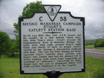
Second Manassas Campaign
Stuart's Catlett Station Raid
Erected 1997 by Department of Historic Resources. (Marker Number C-58.)
Topics and series. This historical marker is listed in this topic list: War, US Civil. In addition, it is included in the Virginia Department of Historic Resources (DHR) series list. A significant historical date for this entry is August 22, 1862.
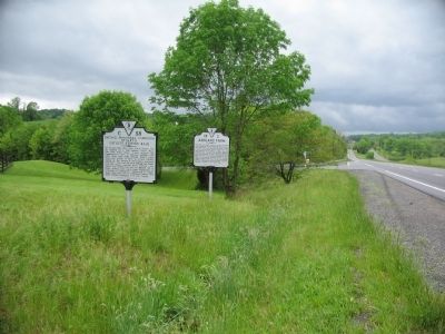
Location. 38° 42.215′ N, 77° 52.391′ W. Marker is near Warrenton, Virginia, in Fauquier County. Marker is at the intersection of Lee Highway (U.S. 211) and Holtzclaw Road (County Route 681), on the right when traveling east on Lee Highway. Touch for map. Marker is in this post office area: Warrenton VA 20186, United States of America. Touch for directions.
Other nearby markers. At least 8 other markers are within 4 miles of this marker, measured as the crow flies. Ashland Farm (a few steps from this marker); Waterloo Bridge (approx. 1.9 miles away); a different marker also named Second Manassas Campaign (approx. 2 miles away); Campaign of Second Manassas (approx. 3.1 miles away); Fauquier County Veterans Memorial (approx. 3.6 miles away); Leeton Forest (approx. 3.6 miles away); Warrenton (approx. 3.7 miles away); Black Horse Cavalry (approx. 3.7 miles away). Touch for a list and map of all markers in Warrenton.
More about this marker. This marker replaced a marker from the 1930s with this same number titled “Campaign of Second Manassas” which read “By this road Stuart came on his raid to Catlett’s Station, August 22, 1962. At that time most of the Union troops were guarding the passages of the Rappahannock River. Crossing at Waterloo Bridge, Stuart moved around the right of Pope’s army to its rear. This raid should have awakened Pope to his dangerous position.” Originally only half a mile west of Warrenton, it later reported to be here, four miles west, and was missing by 1989 until replaced by the current marker.
Credits. This page was last revised on June 16, 2016. It was originally submitted on May 16, 2008, by Craig Swain of Leesburg, Virginia. This page has been viewed 1,203 times since then and 21 times this year. Photos: 1, 2, 3. submitted on May 16, 2008, by Craig Swain of Leesburg, Virginia.


