Marker Logo HMdb.org THE HISTORICAL
MARKER DATABASE
“Bite-Size Bits of Local, National, and Global History”
Near Warrenton in Fauquier County, Virginia — The American South (Mid-Atlantic)
 

Ashland Farm


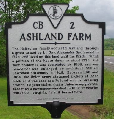
Ashland Farm Marker image. Click for full size.
Photographed By Craig Swain, May 10, 2008
1. Ashland Farm Marker
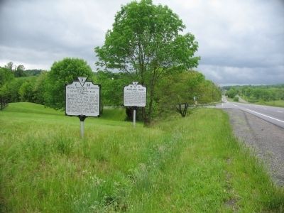
Inscription. The Holtzclaw family acquired Ashland through a grant issued by Lt. Gov. Alexander Spotswood in 1724, and lived on this land until the 1920s. While a portion of the house dates to about 1725, the main residence was completed by 1889, and was remodeled and enlarged by architect William Lawrence Bottomley in 1929. Between 1861 and 1864, the Union army stationed pickets at Ashland, as it was used as a Federal medical dressing station. Legend claims that a Union army payroll was hidden by a paymaster who died in 1862 at nearby Waterloo, Virginia, is still buried here.
 
Erected 1992 by Department of Historic Resources. (Marker Number CB-2.)
 
Topics and series. This historical marker is listed in these topic lists: Settlements & SettlersWar, US Civil. In addition, it is included in the Virginia Department of Historic Resources (DHR) series list. A significant historical year for this entry is 1724.
 
Location. 38° 42.212′ N, 77° 52.396′ W. Marker is near Warrenton, Virginia, in Fauquier County. Marker is at the intersection of Lee Highway (U.S. 211) and Holtzclaw Road (Route 681), on the right when traveling east on Lee Highway. Touch for map. Marker is in this post office area: Warrenton VA 20186, United States of America. Touch for directions.
 
Other nearby markers. At least 8 other markers are within 4 miles of this marker, measured as the crow flies
Paid Advertisement
Click on the ad for more information.
Please report objectionable advertising to the Editor.
Click or scan to see
this page online
. Second Manassas Campaign (a few steps from this marker); Waterloo Bridge (approx. 1.9 miles away); a different marker also named Second Manassas Campaign (approx. 2 miles away); Campaign of Second Manassas (approx. 3 miles away); Fauquier County Veterans Memorial (approx. 3.6 miles away); Leeton Forest (approx. 3.6 miles away); Warrenton (approx. 3.7 miles away); Black Horse Cavalry (approx. 3.7 miles away). Touch for a list and map of all markers in Warrenton.
 
Virginia C 58 and CB 2 Along Lee Highway image. Click for full size.
Photographed By Craig Swain
2. Virginia C 58 and CB 2 Along Lee Highway
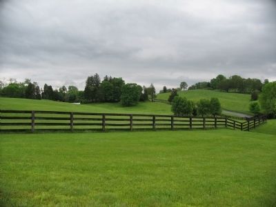
Portions of the Original Ashland Tract image. Click for full size.
Photographed By Craig Swain, May 10, 2008
3. Portions of the Original Ashland Tract
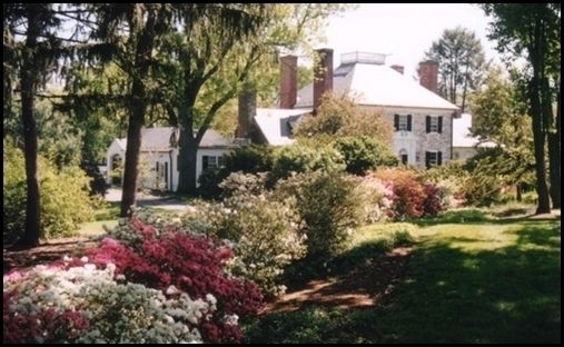
Ashland Farm image. Click for full size.
2008
4. Ashland Farm
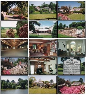
Ashland Farm Front View image. Click for full size.
circa 2008
5. Ashland Farm Front View
Various views of the Ashland Plantation as seen today.
 
 
Credits. This page was last revised on June 16, 2016. It was originally submitted on May 16, 2008, by Craig Swain of Leesburg, Virginia. This page has been viewed 4,427 times since then and 177 times this year. Photos:   1, 2, 3. submitted on May 16, 2008, by Craig Swain of Leesburg, Virginia.   4, 5. submitted on June 23, 2008.
Share this page.  
Share on Tumblr
m=7748

CeraNet Cloud Computing sponsors the Historical Marker Database.
This website earns income from purchases you make after using our links to Amazon.com. We appreciate your support.
Paid Advertisement
Apr. 19, 2024