Near Falling Spring in Alleghany County, Virginia — The American South (Mid-Atlantic)
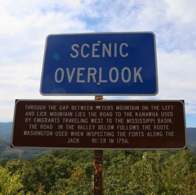
The Road to the Kanawha
and Washington’s Route
— Scenic Overlook —
Topics. This historical marker is listed in these topic lists: Military • Roads & Vehicles • Settlements & Settlers • Wars, US Indian. A significant historical year for this entry is 1756.
Location. 37° 51.311′ N, 79° 57.891′ W. Marker is near Falling Spring, Virginia, in Alleghany County. Marker is on Hot Springs Road (U.S. 220) south of Falls Road (County Route 640), on the left when traveling north. Touch for map. Marker is in this post office area: Covington VA 24426, United States of America. Touch for directions.
Other nearby markers. At least 8 other markers are within 6 miles of this marker, measured as the crow flies. Falling Spring Falls (approx. 1.3 miles away); Fort Breckenridge (approx. 2.8 miles away); Alleghany's Heroic Dead (approx. 4.6 miles away); a different marker also named Alleghany's Heroic Dead (approx. 4.6 miles away); Alleghany's Heroic Dead. (approx. 4.6 miles away); Alleghany County Confederate Soldiers Monument (approx. 4.7 miles away); Fort Young (approx. 5.6 miles away); Averell’s Salem Raid (approx. 5.8 miles away). Touch for a list and map of all markers in Falling Spring.
Click on the ad for more information.
Please report objectionable advertising to the Editor.
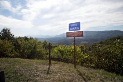
sectionhead>More about this marker. There is a post to the left of this marker (visible in Photo 2) of the same size and height used for Virginia State Historical markers, but a search of the state historical markers guidebooks yields no missing official marker for this location.Please report objectionable advertising to the Editor.
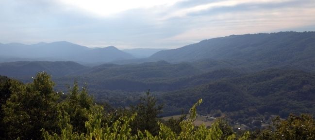
Regarding The Road to the Kanawha. The “road to the Kanawha” visible from this overlook is today’s Midland Trail (U.S. Route 60). The “road in the valley below” is the Jackson River Turnpike (County Routes 687 in Allegheny County and 615 in Bath County), an alternate route between Covington and Hot Springs.
Also see . . . James River and Kanawha Turnpike. “The historic James River & Kanawha Turnpike, now the route of U.S. 60 and parts of Interstate 64, began as a meandering game trail. Native Americans used the trail for centuries to reach the Kanawha salt licks, and later it was an important passage for European immigration through the Appalachians. Col. Andrew Lewis’s army traveled over it to the Battle of Point Pleasant in 1774. By 1785, the state of Virginia authorized construction of the Old State Road, along the path of the Lewis trail. In 1791, the road was improved to the head of navigable water on the Kanawha River at Kellys Creek (present Cedar Grove), where westward travelers secured bateaux (flatboats) made at ‘the Boatyards’ for their downstream journey.” (Submitted on September 27, 2014.)
Credits. This page was last revised on June 16, 2016. It was originally submitted on September 27, 2014, by J. J. Prats of Powell, Ohio. This page has been viewed 679 times since then and 21 times this year. Photos: 1, 2, 3. submitted on September 27, 2014, by J. J. Prats of Powell, Ohio.


