Belle View near Alexandria in Fairfax County, Virginia — The American South (Mid-Atlantic)
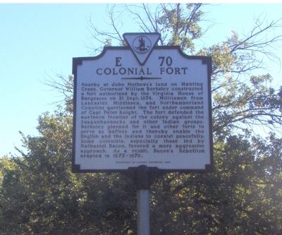
Colonial Fort
Erected 1999 by Department of Historic Resources. (Marker Number E-70.)
Topics and series. This historical marker is listed in these topic lists: Colonial Era • Forts and Castles • Native Americans. In addition, it is included in the Virginia Department of Historic Resources (DHR) series list. A significant historical date for this entry is September 21, 1674.
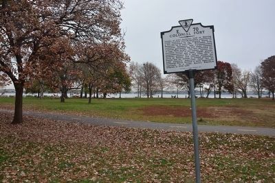
Location. 38° 46.763′ N, 77° 3.111′ W. Marker is near Alexandria, Virginia, in Fairfax County. It is in Belle View. Marker can be reached from George Washington Memorial Parkway (at milepost 7), on the right when traveling north. Located in the first parking lot of Belle Haven Park. Exit parkway on unnamed road to Belle Haven Marina and then take left turn into parking areas. Touch for map. Marker is in this post office area: Alexandria VA 22307, United States of America. Touch for directions.
Other nearby markers. At least 5 other markers are within walking distance of this marker. Historic Jones Point (about 300 feet away, measured in a direct line); Wasteland or Wetland? (about 600 feet away); These Trees (approx. 0.2 miles away); A Place to Rest—or Nest (approx. 0.4 miles away); Anatomy of a Tidal Marsh (approx. 0.6 miles away). Touch for a list and map of all markers in Alexandria.
More about this marker. This marker replaced the original marker numbered E-70 with the same name that stood on Route 1 near Fort Hunt Road. That marker read Here on Hunting Creek, Governor Berkeley in 1676, built a fort for defense against the Susquehannock Indians in the troubles that led to Bacon's Rebellion.
Also see . . . George Washington Memorial Parkway. (Submitted on December 20, 2006, by Roger Dean Meyer of Yankton, South Dakota.)
Credits. This page was last revised on January 27, 2023. It was originally submitted on December 20, 2006, by Roger Dean Meyer of Yankton, South Dakota. This page has been viewed 2,599 times since then and 47 times this year. Photos: 1. submitted on December 20, 2006, by Roger Dean Meyer of Yankton, South Dakota. 2. submitted on December 31, 2015, by A. Taylor of Laurel, Maryland. • J. J. Prats was the editor who published this page.

