Near Washington in Rappahannock County, Virginia — The American South (Mid-Atlantic)
Music, Omens, and Destiny
Heth’s Camp
— Gettysburg Campaign —
After Confederate Gen. Robert E. Lee’s stunning victory at Chancellorsville in May 1863, he led the Army of Northern Virginia west to the Shenandoah Valley, then north through central Maryland and across the Mason-Dixon Line into Pennsylvania. Union Gen. George G. Meade, who replaced Gen. Joseph Hooker on June 28, led the Army of the Potomac in pursuit. Confederate cavalry commander Gen. J.E.B. Stuart cut Federal communications and rail lines and captured supplies. The armies collided at Gettysburg on July 1, starting a battle that neither general planned to fight there. • Three days later, the defeated Confederates retreated, crossing the Potomac River into Virginia on July 14.
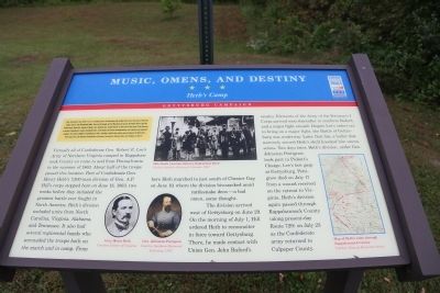
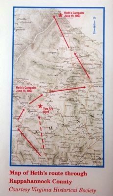
Virtually all of Confederate Gen. Robert E. Lee’s Army of Northern Virginia camped in Rappahannock County en route to and from Pennsylvania in the summer of 1863. About half of the troops passed this location. Part of Confederate Gen. Henry Heth’s 7,300-man division of Gen. A.P. Hills corps stopped here on June 18, 1863, two weeks before they initiated the greatest battle ever fought in North America. Heth’s division included units from North Carolina, Virginia, Alabama, and Tennessee. It also had several regimental bands who serenaded the troops both on the march and in camp. From here Heth marched to just south of Chester Gap on June 19, where the division bivouacked amid rattlesnake dens—a bad omen, some thought.
The division arrived west of Gettysburg on June 29. On the morning of July 1, Hill ordered Heth to reconnoiter in force toward Gettysburg. There, he made contact with Union Gen. John Buford’s cavalry. Elements of the Army of the Potomac’s I Corps arrived soon thereafter to reinforce Buford, and a major fight ensued. Despite Lee’s orders not to bring on a major fight, the Battle of Gettysburg was underway. Later that day, a bullet that narrowly missed Heth’s skull knocked him unconscious. Two days later, Heth’s division, under Gen. Johnston Pettigrew, took part in Pickett’s Charge, Lee’s last gasp at Gettysburg. Pettigrew died on July 17 from a wound received on the retreat to Virginia. Heth’s division again passed through Rappahannock County (along present-day Route 729) on July 23 as the Confederate army returned to Culpeper County.
Erected by Civil War Trails.
Topics. This historical marker is listed in this topic list: War, US Civil. A significant historical month for this entry is May 1863.
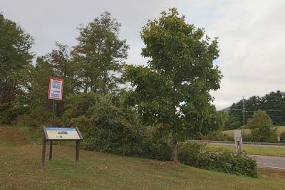
Location. 38° 41.204′ N, 78° 11.349′ W. Marker is near Washington, Virginia, in Rappahannock County. Marker is on Lee Highway (U.S. 211). It is at the Rappahannock County High School. Touch for map. Marker is at or near this postal address: 12576 Lee Hwy, Washington VA 22747, United States of America. Touch for directions.
Other nearby markers. At least 8 other markers are within 3 miles of this marker, measured as the crow flies. Banks’s Grand Review (approx. 0.8 miles away); Washington, Virginia (approx. 2.1 miles away); The Maples (approx. 2.2 miles away); Ellerslie (approx. 2.2 miles away); Washington Graded School (approx. 2.3 miles away); Historic Stone Marker (approx. 2.3 miles away); Kitty Payne (approx. 2.3 miles away); Honored In Their Generation (approx. 2.4 miles away). Touch for a list and map of all markers in Washington.
More about this marker. On the center of the interpretative panel, there is a photograph captioned “26th North Carolina Infantry Regimental Band.” On the bottom, towards the left are two portraits, “Gen. Henry Heth” and “Gen. Johnston Pettigrew.” On the lower right is a “map of Heth’s route through Rappahannock County.”
Credits. This page was last revised on June 16, 2016. It was originally submitted on September 28, 2014, by J. J. Prats of Powell, Ohio. This page has been viewed 604 times since then and 10 times this year. Photos: 1, 2, 3. submitted on September 28, 2014, by J. J. Prats of Powell, Ohio.


