Saint John in Saint John County, New Brunswick — The Atlantic Provinces (North America)
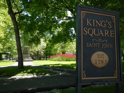
King’s Square
Carré King’s Square
— Established 1785/Fondé en 1785 —
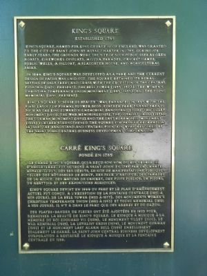
King’s Square, named for King George III of England, was granted to the City of Saint John by royal charter in 1785. During its early years, the grounds were the site of such public uses as oxen roasts, fireworks displays, militia parades, cricket games, public wells, a pillory, a slaughter house, and agricultural fairs.
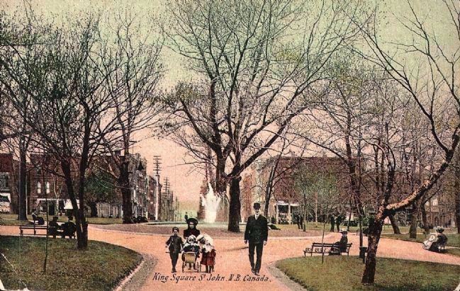
In 1844, King’s Square was developed as a park and the current design of paths was laid out. The square retained it rural setting of only trees and grass with the exception of the central fountain (1851-present), the bell tower (1855-1877), the Women’s Christian Temperance Union Monument (1883-1963), and the Young Memorial (1891-present).
King’s Square’s “Sense of beauty” was enhanced in 1893 with the first layout of formal flower beds. Further park enhancements such as the King Edward VII Memorial Bandstand (1908), the Tilley Monument (1910), the War Memorial (1925), the Loyalist Cross (1934), the Gorman Monument (1962), and the Last Alarm Bell Monument (1986) further strengthened the square for passive recreation. In 1988, the bandstand and central fountain were restored by the Saint John Central Business Development Corporation.
French
Le carré King’s Square, qui a reçu son nom du roi George III d’Angleterre. Fut octroyé à Saint John en 1785 par la charte royale. Des ses débuts, le site de manifestations publiques telles de rôtissages de boeuf, des feux d’artifice, des parades de la milice, des matchs de cricket, des puits public, un pilori, un abattoir et des expositions agricoles.
King’s Square devint en 1844 un parc et le plan d’aménagement actuel fut conçu. A l’exception de la fontaine centrale (1851 à nos jours), de la bell tower (1855 à 1877), des monuments Women’s Christian Temperance Union (1883 à 1963) et Young Memorial (1891 à nos jours), il n’y a dans le parc que les arbres et du gazon.
Des plates-bandes de fleurs ont été ajoutées en 1893 pour rehausser la beauté de King’s Square. Le kiosque à musique à la mémoire du roi Edouard VII (1908), le monument Tilley (1910), le War Memorial (1925), la Loyalist Cross (1934), le monument Gorman (1962) et le monument Last Alarm Bell (1986) embellissent également la carré. La Saint John Central Business Development Corporation a restauré le kiosque à musique et la fontaine centrale en 1988.
Topics. This historical marker is listed in this topic list: Notable Places. A significant historical year for this entry is 1785.
Location. 45° 16.407′ N, 66° 3.522′ W. Marker is in Saint John, New Brunswick, in Saint John County. Marker is on Charlotte Street close to King Street, on the left when traveling south. Touch for map. Marker is at or near this postal address: 86 Charlotte Street, Saint John NB E2L, Canada. Touch for directions.
Other nearby markers. At least 8 other markers are within walking distance of this marker. King Edward VII Memorial Bandstand (a few steps from this marker); Saint John City Market (within shouting distance of this marker); Saint John’s First Wind Grist Mill (within shouting distance of this marker); Imperial Theatre (about 90 meters away, measured in a direct line); No. 2 Mechanics’ Volunteer Company Engine House (about 120 meters away); Saint John’s Original Burial Ground (about 120 meters away); Founding of New Brunswick (about 120 meters away); The Great Fire of 1877 | L’incendie de 1877 (about 150 meters away). Touch for a list and map of all markers in Saint John.
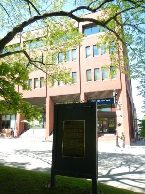
More about this marker. This marker is located at the Charlotte Street entrance to King's Square Park.
Credits. This page was last revised on June 16, 2016. It was originally submitted on September 28, 2014, by Barry Swackhamer of Brentwood, California. This page has been viewed 520 times since then and 15 times this year. Photos: 1, 2, 3. submitted on September 28, 2014, by Barry Swackhamer of Brentwood, California. 4. submitted on September 30, 2014. • Andrew Ruppenstein was the editor who published this page.


