Near Spicer in Kandiyohi County, Minnesota — The American Midwest (Upper Plains)
Olof Olson Haugen
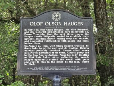
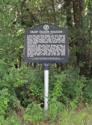
On August 21, 1862, Olof Haugen traveled to Green Lake to get the mail and do trading. Dakota warriors probably overtook Haugen about seven miles to the northeast of his home. A burial party, led by the Rev. Andrew Jackson, found his body floating on West Twin Lake. After suffering his wound, Haugen apparently stuffed the wound with grass and went to hide in the brush by the lake, where he died.
the State of Minnesota through the Minnesota Historical Society from the Arts and
Cultural Heritage Fund and the Kandiyohi County Historical Society.
Erected by the State of Minnesota through the Minnesota Historical Society and the Kandiyohi County Historical Society.
Topics and series. This historical marker is listed in these topic lists: Settlements & Settlers • Wars, US Indian . In addition, it is included in the Minnesota Historical Society series list. A significant historical month for this entry is May 1859.
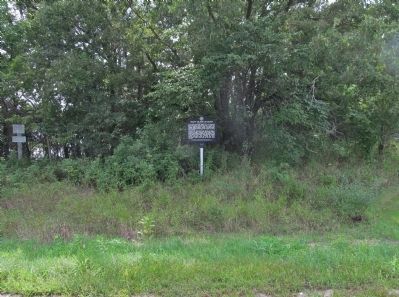
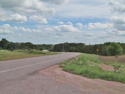
Location. 45° 13.483′ N, 94° 59.203′ W. Marker is near Spicer, Minnesota, in Kandiyohi County. Marker is on County Highway 9, 0.6 miles south of 113th Avenue Northeast (County Highway 10), on the right when traveling south. Marker is near 104th Avenue Northeast, on the northeast side of West Twin Lake. Touch for map. Marker is in this post office area: Spicer MN 56288, United States of America. Touch for directions.
Other nearby markers. At least 8 other markers are within 4 miles of this marker, measured as the crow flies. Victory Dance (approx. ¾ mile away); Spicer (approx. 2½ miles away); Veterans Memorial (approx. 2½ miles away); Little Crow's Camp (approx. 3 miles away); Fullerville (approx. 3.2 miles away); Kandiyohi County's First Church (approx. 3.4 miles away); The Erickson Cabin (approx. 3.4 miles away); Green Lake Village and Mill (approx. 3.7 miles away). Touch for a list and map of all markers in Spicer.
More about this marker. The marker has the Historic Site seal of the Kandiyohi County Historical Society · 1895.
In August 1862, the Minnesota Dakota, also known by the French term, “Sioux," waged war against the United States following two years of unfulfilled treaty obligations. After attacking the Redwood (Lower Sioux) Agency, a remote government outpost, the Dakota moved with speed and surprise in southwestern Minnesota and what was then eastern Dakota Territory, killing nearly everyone in their path. They killed approximately 800 settlers and soldiers, took many prisoners, and caused extensive property damage throughout the Minnesota River Valley.
While Olof Haugen was heading to Green Lake, a Dakota war party came upon his homestead and killed both his wife Bergeret and son Frederick.
Related marker. Click here for another marker that is related to this marker.
Also see . . .
1. Study Resource Guide · U.S.-Dakota War of 1862 · Kandiyohi County. (Submitted on October 7, 2014.)
2. 1862 Dakota War. "It was the largest Indian war in American history. The main battleground was the entire Minnesota River Valley in southern and central Minnesota. The uprising spread into the Dakota Territories and sent panic into Nebraska, Iowa and Wisconsin." (Submitted on October 7, 2014.)
3. The U.S.-Dakota War of 1862. (Submitted on October 7, 2014.)
Additional keywords. U.S.–Dakota War of 1862; Olaf Olson Haugen
Credits. This page was last revised on June 16, 2016. It was originally submitted on October 7, 2014, by Keith L of Wisconsin Rapids, Wisconsin. This page has been viewed 739 times since then and 23 times this year. Photos: 1, 2, 3, 4. submitted on October 7, 2014, by Keith L of Wisconsin Rapids, Wisconsin.


