Near Wallace in Wallace County, Kansas — The American Midwest (Upper Plains)
Camp Pond Creek & Fort Wallace on the BOD
Inscription.
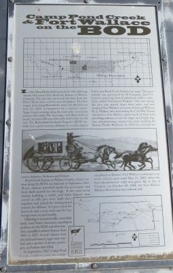
In 1865 David Butterfield opened the 592-mile long Smoky Hill route from Atchison, Kansas to Denver, Colorado. His new line cut nearly tow days from the Platte River route used by most freighters. The first wagon train along Butterfield's route left Atchison on June 25, 1865, accompanied by a military escort. Stages began running along the route after several way stations were built. The first stage, with Butterfield on board arrived in Denver after only twelve days on the trail. The Butterfield Overland Dispatch (BOD) initially was a great success, offering tri-weekly express service between Atchison and Denver.
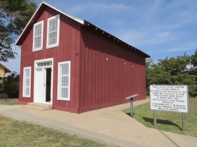
Pond Creek Station in Wallace County, a home station along the BOD, was laid out in September 1865. Home stations provided meals for passengers and fresh draft animals for the stage. A two-story wood station building, a stable, and three dugouts that served as rifle pits were build close together and joined by underground tunnels for defense. A stone corral for livestock and a rock enclosure for hay storage were located nearby.
Objecting to increased traffic across their lands, some Native Americans caused great problems for the BOD and other travelers, especially in western Kansas, from 1865 to 1867. Several stations were attacked and burned, stages were waylaid, and a number of drivers, passengers, and Indians were killed.
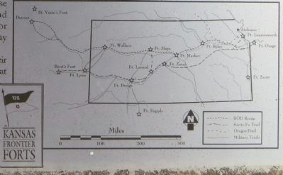
In September 1865 Camp Pond Creek, a military post, was established near Pond Creek Station (see map). This post initially was garrisoned by H Company, 2nd U.S. Cavalry, consisting of ex-Confederate soldiers some-times called “Galvanized Yankees.” The next spring the post was moved about three miles east and renamed Fort Wallace in honor of General William H.L. Wallace, who died during the Civil War. Troops stationed at Fort Wallace spent much of their time providing military escorts for stages and freight wagons, and protecting construction crews building the Kansas Pacific Railroad. In 1870 the railroad was completed to Denver. Fort Wallace continued as an active military post until May 31, 1882, when the final abandonment order was given. By an Act of Congress on October 19, 1888, the Fort Wallace Military Reservation was ordered sold.
Topics. This historical marker is listed in these topic lists: Forts and Castles • Roads & Vehicles. A significant historical date for this entry is May 31, 1865.
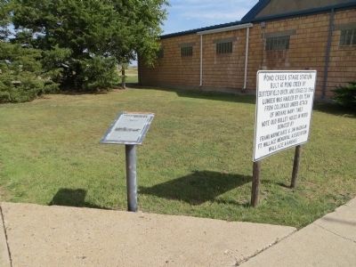
Location. 38° 54.619′ N, 101° 34.991′ W. Marker is near Wallace, Kansas, in Wallace County. Marker can be reached from Route 40 at milepost 25.5. Marker is at the Fort Wallace Museum, east of Wallace city limits. Touch for map. Marker is in this post office area: Wallace KS 67761, United States of America. Touch for directions.
Other nearby markers. At least 1 other marker is
within walking distance of this marker. Fort Wallace (within shouting distance of this marker).
Credits. This page was last revised on June 16, 2016. It was originally submitted on October 12, 2014, by Bill Kirchner of Tucson, Arizona. This page has been viewed 551 times since then and 36 times this year. Photos: 1, 2, 3, 4. submitted on October 12, 2014, by Bill Kirchner of Tucson, Arizona. • Andrew Ruppenstein was the editor who published this page.


