Near Blackwell in Coke County, Texas — The American South (West South Central)
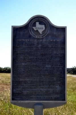
Southern Overland Mail, 1858-1861
(Butterfield Stage)
Stage traveled at a run, despite lack of good roads. A signal given approaching a station would have fresh horses ready and food on the table for crew and passengers. Route had stations 12 to 113 miles apart, and was sometimes changed to get water. Crew and passengers wore guns; to reduce danger of Indian attacks, mules (less coveted than horses) were used west of Ft. Belknap. The trip one way took 25 days—seven spent crossing Texas, from Preston (now under Lake Texoma) to Jacksboro, Ft. Belknap, Ft. Chadbourne and El Paso. One way fare for the 2700 miles was $200. Passengers rarely stopped off, because they might not find seats on a later stage. Merchants in Jacksboro and other towns used Butterfield’s light freight service to make mail-order sales.
Greatest contribution of the Overland stage was its carrying news; coaches also brought mail from the west one to 10 days faster than it came by ship.
Service was ended in 1861 by the Civil War.
Erected 1966 by State Historical Survey Committee and Moody Foundation . (Marker Number 4983.)
Topics and series. This historical marker is listed in these topic lists: Communications • Roads & Vehicles. In addition, it is included in the Butterfield Overland Mail series list. A significant historical year for this entry is 1350.
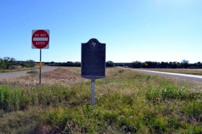
Location. 32° 0.927′ N, 100° 16.582′ W. Marker is near Blackwell, Texas, in Coke County. Marker is on U.S. 277, 0.2 miles north of Texas Highway 70, in the median. Marker is located at the northern point of the median created by the separation of the northbound and southbound lanes of US 277 just north of State Highway 70. Touch for map. Marker is in this post office area: Bronte TX 76933, United States of America. Touch for directions.
Other nearby markers. At least 8 other markers are within 9 miles of this marker, measured as the crow flies. Indian Rock Shelters (approx. 0.9 miles away); Route of the Southern Overland Mail Line (approx. 2.7 miles away); Fort Chadbourne (approx. 2.8 miles away); James Franklin Byrd (approx. 8.1 miles away); Hayrick (approx. 8.1 miles away); Bronte Veterans Memorial (approx. 8.9 miles away); Bronte Depot (approx. 8.9 miles away); Fort Chadbourne C.S.A. / Texas Civil War Frontier Defense (approx. 8.9 miles away). Touch for a list and map of all markers in Blackwell.
More about this marker. Marker is part of the Early Travel, Communication and Transportation series of Texas state markers.
Also see . . .
1. Butterfield Overland Mail - Wikipedia entry. (Submitted on October 13, 2014.)
2. Butterfield Overland Mail. From the Texas State Historical Association’s “Handbook of Texas Online”. (Submitted on October 13, 2014.)
Additional commentary.
1. Identical Marker
There is an identical marker, erected in 1966 with the assistance of the Moody Foundation, located in central Coke County on State Highway 158 between Bronte and Robert Lee.
— Submitted May 8, 2015, by Duane Hall of Abilene, Texas.
Credits. This page was last revised on November 2, 2020. It was originally submitted on October 13, 2014, by Duane Hall of Abilene, Texas. This page has been viewed 1,123 times since then and 35 times this year. Photos: 1, 2, 3. submitted on October 13, 2014, by Duane Hall of Abilene, Texas.


