Near Quapaw in Ottawa County, Oklahoma — The American South (West South Central)
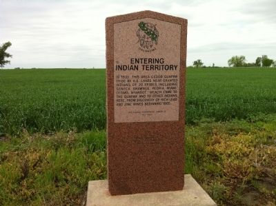
Entering Indian Territory
In 1833, this area ceded Quapaw Tribe by U.S. Lands near granted Indians of 20 Tribes including Seneca, Shawnee, Peoria, Miami, Ottawa, Wyandot. Wealth came to the Quapaw and other Indians here, from discovery of lead and zinc mines beginning in 1905.
Erected 1995 by Oklahoma Historical Society. (Marker Number 164.)
Topics and series. This historical marker is listed in these topic lists: Industry & Commerce • Native Americans. In addition, it is included in the Oklahoma Historical Society series list. A significant historical year for this entry is 1833.
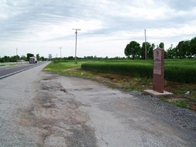
Location. 36° 59.802′ N, 94° 44.452′ W. Marker is near Quapaw, Oklahoma, in Ottawa County. Marker is on State Highway 66, 0.1 miles south of Kansas State Line, on the left when traveling north. Touch for map. Marker is in this post office area: Quapaw OK 74363, United States of America. Touch for directions.
Other nearby markers. At least 8 other markers are within 2 miles of this marker, measured as the crow flies. Camp Logan (approx. 1.3 miles away in Kansas); American Legion Post 206 Veterans Memorial (approx. 1.8 miles away in Kansas); Veterans Memorial (approx. 1.8 miles away in Kansas); Indiana House (approx. 1.9 miles away in Kansas); Crowell Bank (approx. 1.9 miles away in Kansas); Café on the Route, Baxter Springs, Kansas (approx. 2 miles away in Kansas); Illinois Cash Store (approx. 2 miles away in Kansas); Opperman Harness and Saddle Shop (approx. 2 miles away in Kansas).
Credits. This page was last revised on June 16, 2016. It was originally submitted on October 13, 2014, by Michael Manning of Woodlawn, Tennessee. This page has been viewed 551 times since then and 37 times this year. Photos: 1. submitted on October 13, 2014, by Michael Manning of Woodlawn, Tennessee. 2. submitted on January 10, 2015, by William Fischer, Jr. of Scranton, Pennsylvania. • Bernard Fisher was the editor who published this page.

