Dartmouth in Halifax Region, Nova Scotia — The Atlantic Provinces (North America)
Before the Canal

Photographed By Barry Swackhamer, June 15, 2014
1. Before the Canal Marker
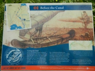
Caption: Above: This map of the canal line, drawn by Francis Hall, portrays a very optimistic view of the potential canal. This is the map that Charles R. Fairbanks took to England when he went to garner financial support in 1829. (Map Courtesy of Nova Scotia Archives).
You are now standing about one third of the way between Lake Micmac to the South (left) and Lake Charles to the North (right). Before canal construction began in 1826 there was no flow of water between these two lakes. The Mi’kmaq and early settlers wishing to go from one lake to the other had to portage or carry their boats through the 1.5 kilometres of forested area. The man made canal cut with its two locks took three years to construct and was the most difficult obstacle to overcome on the 115 km long waterway which stretched from Halifax Harbour to the Bay of Fundy. As many as 300 labourers worked on this section of the waterway. Many of them, along with their families, lived nearby and the remains of their tiny dwellings many be seen along the route.
Erected by Shubenacadie Canal Commission. (Marker Number 01.)
Topics. This historical marker is listed in this topic list: Waterways & Vessels. A significant historical year for this entry is 1826.
Location. 44° 42.099′ N, 63° 33.239′ W. Marker is in Dartmouth, Nova Scotia, in Halifax Region. Marker can be reached from Lock Road, on the left when traveling north. Touch for map. Marker is at or near this postal address: 54 Lock Road, Dartmouth NS B2X, Canada. Touch for directions.
Other nearby markers. At least 8 other markers are within walking distance of this marker. The Fairbanks Solution (within shouting distance of this marker); Of Bough and Bark (within shouting distance of this marker); Historic Shubenacadie Canal System (within shouting distance of this marker); Official Groundbreaking 1829 (about 90 meters away, measured in a direct line); Canal Shubenacadie Canal (about 120 meters away); Waste Weir and Holding Pond (about 120 meters away); A Village of the Most Primitive Description (about 120 meters away); A Testament to Hard Work (about 240 meters away). Touch for a list and map of all markers in Dartmouth.
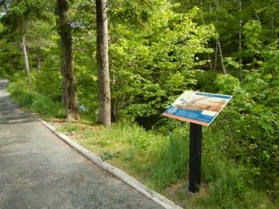
More about this marker. This marker is in Shubie Park near Lock 3.
Credits. This page was last revised on June 16, 2016. It was originally submitted on October 14, 2014, by Barry Swackhamer of Brentwood, California. This page has been viewed 369 times since then and 9 times this year. Photos: 1, 2. submitted on October 14, 2014, by Barry Swackhamer of Brentwood, California. • Andrew Ruppenstein was the editor who published this page.
