Indiana in Indiana County, Pennsylvania — The American Northeast (Mid-Atlantic)
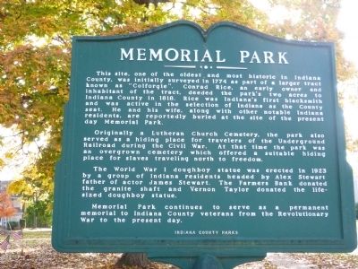
Memorial Park
Originally a Lutheran Church Cemetery, the park also served as a hiding place for travelers of the Underground Railroad during the Civil War. At the time the park was an overgrown cemetery which offered a suitable hiding place for slaves traveling north to freedom.
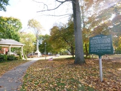
The World War I doughboy statue was erected in 1923 by a group of Indiana residents headed by Alex Stewart father of actor James Stewart. The Farmers Bank donated the granite shaft and Vernon Taylor donated the life—sized doughboy statue.
Memorial Park continues to serve as a permanent memorial to Indiana County veterans from the Revolutionary War to present day.
Erected by Indiana County Parks.
Topics. This historical marker is listed in these topic lists: Abolition & Underground RR • African Americans • Cemeteries & Burial Sites • War, US Civil • War, World I. A significant historical year for this entry is 1774.
Location. 40° 37.173′ N, 79° 9.099′ W. Marker is in Indiana, Pennsylvania, in Indiana County. Marker is at the intersection of Wayne Avenue and Washington Street, on the right when traveling south on Wayne Avenue. Touch for map. Marker is at or near this postal address: 630 Washington Street, Indiana PA 15701, United States of America. Touch for directions.
Other nearby markers. At least 8 other markers are within 2 miles of this marker, measured as the crow flies. The Catawba and Kittanning Native American Trails (approx. ¼ mile away); The Rescue of Anthony Hollingsworth (approx. ¼ mile away); Walk of Fame (approx. ¼ mile away); William H. Sylvis (approx. ¼ mile away); James S. Nance, Jr. (approx. 0.3 miles away); Indiana County (approx. 0.3 miles away); James Maitland Stewart (approx. 0.3 miles away); Moorhead's Fort (approx. 1½ miles away). Touch for a list and map of all markers in Indiana.
Credits. This page was last revised on June 16, 2016. It was originally submitted on October 17, 2014, by Judy King of Pittsburgh, Pennsylvania. This page has been viewed 660 times since then and 13 times this year. Photos: 1, 2. submitted on October 17, 2014, by Judy King of Pittsburgh, Pennsylvania. • Bernard Fisher was the editor who published this page.

