Dartmouth in Halifax Region, Nova Scotia — The Atlantic Provinces (North America)
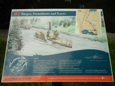
Barges, Steamboats and Scows
Inscription.
Lock 2
You are now looking at the upper sill of Lock 2. The chambers of the first five Locks on the Canal are approximately 21 meters long and 5.5 meters wide.
Therefore the boats and barges used on the system had to be able to fit within these chambers. The watercraft used on the Canal included three steamboats, twelve scows and an 80 ton barge. These craft were used to transport freight and passengers to and from Dartmouth and the interior of the Province. Bricks, pottery and cord wood were common cargo.
An important role of the Canal was to transport equipment required to construct the Waverley gold mine and later materials required by the fledging railway which eventually led to the demise of the Canal
Erected by Shubenacadie Canal Commission. (Marker Number 07.)
Topics. This historical marker is listed in this topic list: Waterways & Vessels.
Location. 44° 41.966′ N, 63° 33.175′ W. Marker is in Dartmouth, Nova Scotia, in Halifax Region. Marker can be reached from Lock Road, on the left when traveling north. Touch for map. Marker is at or near this postal address: 54 Lock Road, Dartmouth NS B2X, Canada. Touch for directions.
Other nearby markers. At least 8 other markers are within walking distance of this marker. Historic Shubenacadie Canal System (a few steps from this marker); A Testament to Hard Work (within shouting distance of this marker); Lightning Strikes at Canal Camp (within shouting distance of this marker); Unique Construction (within shouting distance of this marker); A Village of the Most Primitive Description (about 120 meters away, measured in a direct line); A Changing Lake-scape (about 180 meters away); Of Bough and Bark (about 210 meters away); Before the Canal (approx. 0.3 kilometers away). Touch for a list and map of all markers in Dartmouth.
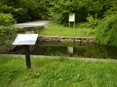
More about this marker. This marker is in Shubie Park on the west side of the canal near the bridge over Lock 2.
Credits. This page was last revised on October 4, 2016. It was originally submitted on October 18, 2014, by Barry Swackhamer of Brentwood, California. This page has been viewed 372 times since then and 4 times this year. Photos: 1, 2. submitted on October 18, 2014, by Barry Swackhamer of Brentwood, California. • Andrew Ruppenstein was the editor who published this page.

