Near Annapolis in Anne Arundel County, Maryland — The American Northeast (Mid-Atlantic)
Pearl Harbor Survivors Association
In Memoriam
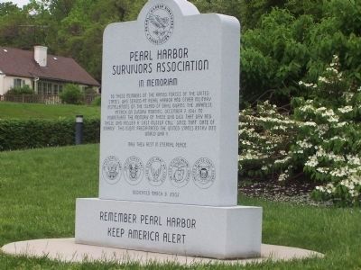
Inscription.
[Front]:
To those members of the Armed Forces of the United States who served at Pearl Harbor and other military installations on the island of Oahu during the Japanese attack on Sunday morning, December 7, 1941, to perpetuate the memory of those who died that day and those who answer a "last muster call" since that "date of infamy." This event precipitated the United States' entry into World War II.
May they rest in eternal peace.
[Engraved near the base are the Seals of the United States Army, United States Navy, United States Army Air Corps, United States Marine Corps, and United States Coast Guard]
Remember Pearl Harbor
Keep America Alert
[Back]:
Marylanders Killed
Robert Everett Arnott USS Pennsylvania BB-38
Albert Eugene Hayden USS Oklahoma BB-37
Clyde Jackson Rawson USS Arizona BB-39
Jack Martin Restivo USS Arizona BB-39
Victor Charles Tambolleo USS Arizona BB-39
Damaged:
USS Maryland BB-46
Erected 2002 by Pearl Harbor Survivors Association.
Topics. This historical marker is listed in these topic lists: Air & Space • War, World II • Waterways & Vessels. A significant historical date for this entry is December 7, 1870.
Location. 38° 59.897′ N, 76° 28.914′ W. Marker is near Annapolis, Maryland, in Anne Arundel County. Marker is on Governor Ritchie Highway (State Highway 450) 0 miles north of State Route 648, in the median. Touch for map. Marker is in this post office area: Annapolis MD 21409, United States of America. Touch for directions.
Other nearby markers. At least 8 other markers are within walking distance of this marker. Maryland World War II Memorial (a few steps from this marker); Prisoner of War Memorial (a few steps from this marker); Albert Cabell Ritchie (within shouting distance of this marker); Battle of the Severn (within shouting distance of this marker); Gold Star Families Monument (about 600 feet away, measured in a direct line); Jonas and Anne Catherine Green Park (approx. ¼ mile away); Providence - 1649 (approx. ¼ mile away); Standing Guard (approx. ¼ mile away). Touch for a list and map of all markers in Annapolis.
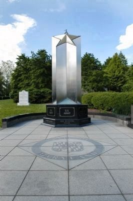
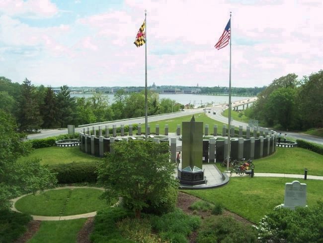
More about this marker. The Marker is adjacent to the Maryland World War II Memorial, just below the scenic overlook containing a memorial to Albert C. Ritchie, the four-term Maryland governor for whom the highway is named.
Also see . . . Pearl Harbor Survivors Association. (Submitted on May 22, 2008, by Tabitha Preast of Hanover, Maryland.)
Credits. This page was last revised on January 4, 2020. It was originally submitted on May 20, 2008, by Richard E. Miller of Oxon Hill, Maryland. This page has been viewed 3,741 times since then and 14 times this year. Photos: 1, 2. submitted on May 20, 2008, by Richard E. Miller of Oxon Hill, Maryland. 3. submitted on May 22, 2008, by Tabitha Preast of Hanover, Maryland. 4. submitted on May 20, 2008, by Richard E. Miller of Oxon Hill, Maryland. • Kevin W. was the editor who published this page.

![Pearl Harbor Survivors Association Marker [Back]. Click for full size. Pearl Harbor Survivors Association Marker [Back] image. Click for full size.](Photos/23/Photo23880.jpg?11252005)

