Gaines in Orleans County, New York — The American Northeast (Mid-Atlantic)
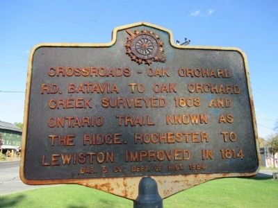
Crossroads
Rd. Batavia to Oak Orchard
Creek surveyed 1803 and
Ontario Trail known as
The Ridge. Rochester to
Lewiston improved in 1814
Erected 1984 by Daughters of the American Revolution & Orleans County Department of History.
Topics and series. This historical marker is listed in this topic list: Roads & Vehicles. In addition, it is included in the Daughters of the American Revolution series list. A significant historical year for this entry is 1803.
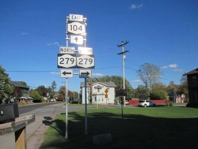
Location. 43° 17.099′ N, 78° 12.934′ W. Marker is in Gaines, New York, in Orleans County. Marker is at the intersection of Ridge Road West (New York State Route 104) and Gaines Road (New York State Route 279), on the right when traveling east on Ridge Road West. Touch for map. Marker is in this post office area: Albion NY 14411, United States of America. Touch for directions.
Other nearby markers. At least 8 other markers are within 2 miles of this marker, measured as the crow flies. Niagara to Genesee Historic Ridge Road (about 400 feet away, measured in a direct line); Burial Ground (about 500 feet away); First Academy (approx. 0.2 miles away); First Church (approx. 0.2 miles away); In Recognition (approx. 0.3 miles away); Masonic Lodge (approx. 0.4 miles away); The Lake Plain (approx. 0.8 miles away); Home of John Proctor (approx. 1.1 miles away). Touch for a list and map of all markers in Gaines.
Also see . . . Glacial Lake Iroquois - Wikipedia. The Ridge, now occupied by NY 104, is so named because it follows an ancient raised sand ridge marking the south shore of Glacial Lake Iroquois (a Greater Lake Ontario). Though the small ridge is hardly noticed by modern travelers, it was very important for road drainage in pioneer times. (Submitted on October 20, 2014, by Anton Schwarzmueller of Wilson, New York.)
Credits. This page was last revised on June 16, 2016. It was originally submitted on October 20, 2014, by Anton Schwarzmueller of Wilson, New York. This page has been viewed 373 times since then and 12 times this year. Last updated on October 22, 2014, by Anton Schwarzmueller of Wilson, New York. Photos: 1, 2, 3. submitted on October 20, 2014, by Anton Schwarzmueller of Wilson, New York. • Bill Pfingsten was the editor who published this page.


