Little Falls in Morrison County, Minnesota — The American Midwest (Upper Plains)
WPA Water Tower & Shelter Building
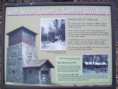
Holding Up The H2O
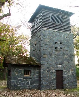
The water tower was completed in 1939 by Works Progress Administration (WPA) workers. It stands three stories high.
Water towers use gravity to create pressure that moves water through supply pipes. Each foot of height off the ground provides added pressure per square inch to meet water demand.
A 5,000-gallon tank is inside the tower. Although no longer in use, it once held enough water to supply drinking, flushing and other water needs of visitors.
The tank was used until 1965 when the park switched to the Little Falls water system.
Rustic Style and the WPA
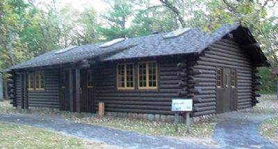
Ever wonder why so many park buildings of the era looked like mountain cabins? WPA workers across the country were operating under a master plan called Rustic Style.
This style, according to an official 1935 manual "uses native materials in proper scale, and through the avoidance of rigid, straight lines... gives the feeling of having been executed by pioneer craftsman with limited hand tools. It thus achieves sympathy with natural surroundings, and the past."
[Photo captions read]
Tower under construction in 1938.
Minnesota Historical Society
Shelter building as it looked in 1936.
Minnesota Historical Society
Erected by Minnesota Dept of Natural Resources.
Topics and series. This historical marker is listed in these topic lists: Architecture • Charity & Public Work • Parks & Recreational Areas. In addition, it is included in the Works Progress Administration (WPA) projects series list. A significant historical year for this entry is 1939.
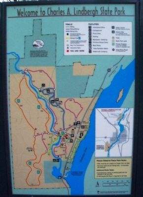
Location. 45° 57.462′ N, 94° 23.412′ W. Marker is in Little Falls, Minnesota, in Morrison County. Marker is adjacent to the Shelter House, about 800 feet SW of the Charles A. Lindbergh State Park entrance station. Touch for map. Marker is at or near this postal address: 1620 Lindbergh Drive South, Little Falls MN 56345, United States of America. Touch for directions.
Other nearby markers. At least 8 other markers are within walking distance of this marker. Childhood Memories of a Magical Place (a few steps from this marker); The Boyhood Farm of Charles Lindbergh (a few steps from this marker); The WPA Builds a Park in the Rustic Style (a few steps from this marker); Big White Pine (within shouting distance of this marker); Tenant Farmer House (about 400 feet away, measured in a direct line); Lindbergh House (about 700 feet away); Lindbergh State Park (approx. 0.2 miles away); A Boyhood on the Mississippi (approx. 0.2 miles away). Touch for a list and map of all markers in Little Falls.
Also see . . .
1. Charles A. Lindbergh State Park MN.
(Submitted on October 29, 2014, by William Fischer, Jr. of Scranton, Pennsylvania.)
2. The WPA in Minnesota. (Submitted on October 29, 2014, by William Fischer, Jr. of Scranton, Pennsylvania.)
3. WPA Projects Throughout Minnesota. (Submitted on October 29, 2014, by William Fischer, Jr. of Scranton, Pennsylvania.)
Credits. This page was last revised on December 10, 2020. It was originally submitted on October 29, 2014, by William Fischer, Jr. of Scranton, Pennsylvania. This page has been viewed 559 times since then and 21 times this year. Photos: 1, 2, 3, 4. submitted on October 30, 2014, by William Fischer, Jr. of Scranton, Pennsylvania. 5. submitted on October 29, 2014, by William Fischer, Jr. of Scranton, Pennsylvania.


