Atlas in Pike County, Illinois — The American Midwest (Great Lakes)
Atlas
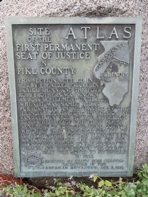
Site of the First Permanent Seat of Justice in Pike County
Erected 1935 by Nancy Ross Chapter, Daughters of the American Revolution.
Topics and series. This historical marker is listed in this topic list: Settlements & Settlers. In addition, it is included in the Daughters of the American Revolution series list. A significant historical year for this entry is 1820.
Location. 39° 30.799′ N, 90° 58.169′ W. Marker is in Atlas, Illinois, in Pike County. Marker is at the intersection of U.S. 54 and Illinois Route 96, on the right when traveling west on U.S. 54. Marker is on the northwest corner. Touch for map. Marker is in this post office area: Rockport IL 62370, United States of America. Touch for directions.
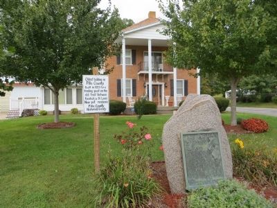
Other nearby markers. At least 8 other markers are within 6 miles of this marker, measured as the crow flies. Oldest Building in Pike County (here, next to this marker); Welcome to Illinois (approx. 3.2 miles away); Civil War Monument (approx. 3˝ miles away); Champ Clark Bridge (approx. 5.9 miles away in Missouri); Henderson Park (approx. 5.9 miles away in Missouri); John Brooks Henderson (approx. 5.9 miles away in Missouri); Floods of 1973 and 1993 (approx. 5.9 miles away in Missouri); Louisiana Public Library (approx. 6 miles away in Missouri). Touch for a list and map of all markers in Atlas.
Additional commentary.
1. Colonel William Ross
William Ross also built the first brick home in Pike County, right across the street from this building. It was a grand two-story farmhouse (borderline mansion) but was torn down in the 1980s.
He had such great hopes in Atlas that he argued with John Wood, who was building up Quincy at the same time Ross was building up Atlas, that he felt sorry for Quincy due to its close proximity to the soon-to-be great city of Atlas. Sadly, Atlas is now a small village while Quincy is a successful city.
Despite Ross’s faith in Atlas, he loaned the money needed to buy the land desired for the new centrally located county seat of Pittsfield. In Pittsfield, he built the first home. This was a two-story Greek Revival house about one block away from the main square, and was also torn down in the 1980s. Later on, he built his grandest home yet, and one of the grandest homes in Pike County, on the eastern outskirts of Pittsfield. President Lincoln visited this home in 1858. It was nearly destroyed by fire in the 1890s but was rebuilt in the Folk Victorian style and still stands. Note To Editor only visible by Contributor and editor
— Submitted July 26, 2019, by Emily Pursley of Pittsfield, Illinois.
Credits. This page was last revised on August 5, 2019. It was originally submitted on November 5, 2014, by Bill Kirchner of Tucson, Arizona. This page has been viewed 897 times since then and 25 times this year. Photos: 1, 2, 3. submitted on November 5, 2014, by Bill Kirchner of Tucson, Arizona. • Al Wolf was the editor who published this page.


