Bowling Green in Pike County, Missouri — The American Midwest (Upper Plains)
Bowling Green
Side A:
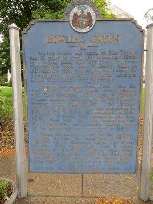
Bowling Green, the capital of Pike County, lies 12 miles in from the Mississippi River on a rolling plain, 880 feet above sea level. First pioneer here, John W. Basye, came in 1820 and by 1823, the settlement, named for Bowling Green, Kentucky, succeeded Louisiana as the Pike County seat of justice.
Here on the pioneer Salt River Trail, the town made a steady growth. Early schools were Pike Academy, 1837; Isaac W. Basye's Normal School, 1867; and J.D.Meriwether's Bowling Green College, 1881. The Chicago and Alton R.R.(G.M.& O.)was completed in 1871 and the St. Louis and Hannibal in 1876. Limestone quarries were opened in the late 1800's. Near here, the first Presbytery of the Cumberland Presbyterian Church west of the Mississippi was organized in 1820.
When the county, named for the explorer Zebulon M. Pike, was organized in 1818, it included all of Missouri's Upper Salt River Country from which have come 9 whole counties and parts of 6 others. Many Pike Countians joined the 1849 Gold Rush, and the ballads "Joe Bowers" and "Sweet Betsy from Pike" are associated with this county.
Side B:
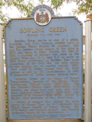
Bowling Green serves as seat of a grain, livestock, and fruit farming county here in the Glacial Plains Region of Missouri. Sac and Fox Indians ceded claims to the area in 1804 and again in 1824. During the War of 1812, a number of settlers who came to the county from Ky, N.C., and S.C. as early as 1808 found protection in Buffalo Fort near Louisiana. In the Civil War, the only action in the county was at nearby Ashley, 1862, when some 30 Union troops held the town against a raid by 150 Confederates. In 1861, 8 companies of Union troops trained here.
Bowling Green was the home of famed Congressman, Speaker of the House, James Beauchamp (Champ) Clark (1850-1921). His son, Bennett Champ Clark (1890-1954), U.S. Senator, was born here, and here also were born diplomat John F. Swift (1829-1891), and Admiral W.R. Purnell (1886-1955). Elliot W. Major, 33rd governor of Mo. lived here.
Points of interest here include the state statue of Champ Clark by F.C. Hibbard; the Clark House known as Honey Shuck; the J.W. Basye and Purnell Houses; and Purnell memorial plaque at the courthouse.
Erected 1957 by State Historical Society of Missouri and State Highway Commission.
Topics and series. This historical marker is listed in this topic list: Settlements & Settlers. In addition, it is included in the Missouri, The State Historical Society of series list. A significant historical year for this entry is 1820.
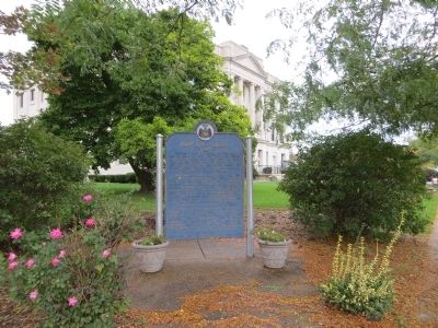
Location. 39° 20.529′ N, 91° 11.664′ W. Marker is in Bowling Green, Missouri, in Pike County. Marker is at the intersection of West Main Street and North Main Cross Street when traveling west on West Main Street. Marker is on the northwest corner. Touch for map. Marker is in this post office area: Bowling Green MO 63334, United States of America. Touch for directions.
Other nearby markers. At least 8 other markers are within 11 miles of this marker, measured as the crow flies. Champ Clark (within shouting distance of this marker); James B. "Champ" Clark House (approx. 0.2 miles away); Louisiana (approx. 8.6 miles away); "Miss Lucille's Garden" (approx. 10.8 miles away); Louisiana Public Library (approx. 10.8 miles away); John Brooks Henderson (approx. 10.9 miles away); Henderson Park (approx. 11 miles away); Champ Clark Bridge (approx. 11 miles away). Touch for a list and map of all markers in Bowling Green.
Credits. This page was last revised on June 16, 2016. It was originally submitted on November 6, 2014, by Bill Kirchner of Tucson, Arizona. This page has been viewed 568 times since then and 30 times this year. Photos: 1, 2, 3. submitted on November 6, 2014, by Bill Kirchner of Tucson, Arizona. • Al Wolf was the editor who published this page.


