St. Peter's in Richmond County, Nova Scotia — The Atlantic Provinces (North America)
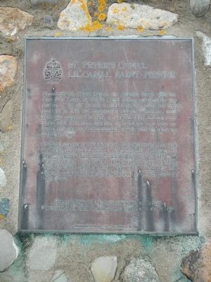
St. Peter’s Canal / Le Canal Saint-Pierre
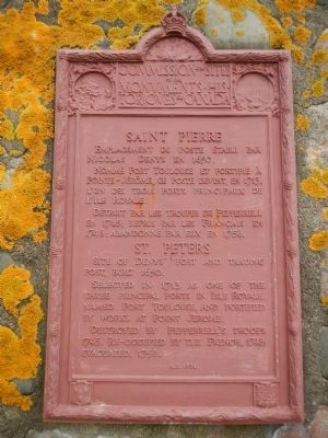
St. Peters / Saint-Pierre
English
Connecting St. Peter’s Bay on the Atlantic Ocean with the Bras d’Or Lakes, St. Peter’s Canal follows substantially the portage of the old French trading days. The route was first surveyed in 1825 but construction did not commence until 1854, was suspended in 1856, renewed in 1865, and not completed until 1869. Since that time the canal has been twice enlarged and can now accommodate vessels with draughts up to sixteen feet.
French
Ce canal qui relie la baie St. Peters sur l’Atlantique aux lacs Bras d’Or suit plus du moins le vieux chemin de portage du Régime français. Son trace fut d’abord arpente 1825 mais sa construction entreprise en 1854, interrompue en 1856, reprise en 1865, ne fut terminée qu’en 1869. Elargi deux fois depuis le canal peut recevoir des navires ayant seize pieds de tirant d’eau.
English
Site of Denys’ fort and trading post, built 1650.
Selected in 1713 as one of the three principal ports in Isle Royale, named Port Toulouse and fortified by works at Point Jerome.
Destroyed by Pepperrell’s troops 1745. Re-occupied by the French, 1748: evacuated, 1758.
French
Emplacement du poste établi par Nicolas Denys en 1650.
Nommé Port Toulouse et fortifié à Pointe-Jerôme, ce post devint, en 1713. L’un des trois ports principaux de l’Ile Royale.
Détruit par les troupes de Pepperrell en 1745; repris par les Français en 1748; abandonné par eux en 1758.
Erected 1931 by Historic Sites and Monument Board of Canada/Commission de lieux et monuments historique du Canada.
Topics. This historical marker is listed in this topic list: Waterways & Vessels. A significant historical year for this entry is 1825.
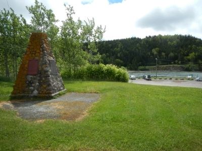
Location. 45° 39.135′ N, 60° 52.242′ W. Marker is in St. Peter's, Nova Scotia, in Richmond County. Marker is on Toulouse Street, on the left when traveling south. Touch for map. Marker is at or near this postal address: 160 Toulouse Street, St Peter's NS B0E, Canada. Touch for directions.
Other nearby markers. At least 5 other markers are within walking distance of this marker. The French Settlement of Saint-Pierre (within shouting distance of this marker); One Place, Four Names (about 210 meters away, measured in a direct line); St, Peter’s and Its Canal (about 240 meters away); Lest We Forget (approx. half a kilometer away); Wallace R. MacAskill (approx. 0.6 kilometers away).
Also see . . .
1. St. Peter's, Nova Scotia - Wikipedia. St. Peter's is located on a narrow isthmus which separates the southern end of Bras d'Or Lake, known as St. Peter's Inlet, to the north from St. Peter's Bay on the Atlantic Ocean to the south. The isthmus is crossed by the St. Peters Canal which is almost exclusively used by pleasure boats in recent decades. (Submitted on November 8, 2014, by Barry Swackhamer of Brentwood, California.)
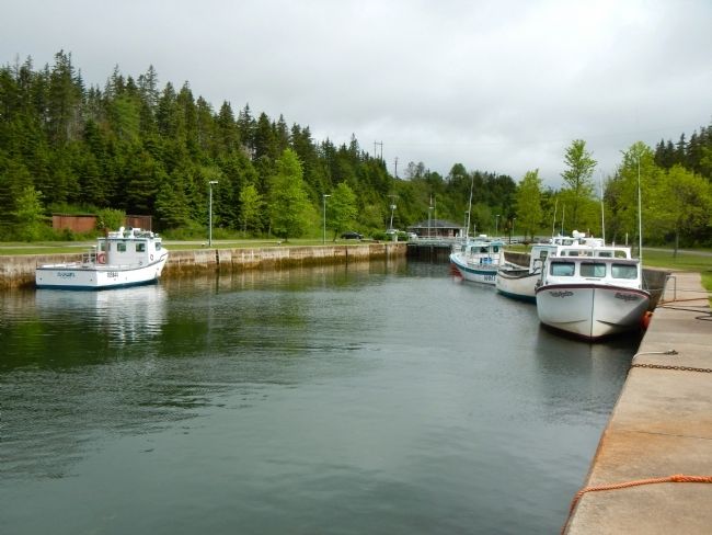
2. St. Peters Canal National Historic Site of Canada - Parks Canada. St. Peters Canal is an 800 metre canal linking the Atlantic Ocean with the Bras d'Or Lakes. Work started on the canal in 1854 and was completed in 1869. View interpretive exhibits, enjoy a picnic lunch, or experience the canal by pleasure craft. (Submitted on November 8, 2014, by Barry Swackhamer of Brentwood, California.)
Credits. This page was last revised on June 16, 2016. It was originally submitted on November 8, 2014, by Barry Swackhamer of Brentwood, California. This page has been viewed 358 times since then and 11 times this year. Photos: 1, 2, 3, 4. submitted on November 8, 2014, by Barry Swackhamer of Brentwood, California. • Andrew Ruppenstein was the editor who published this page.


