Potsdam in St. Lawrence County, New York — The American Northeast (Mid-Atlantic)
Potsdam Raquette River Walk
Fall Island
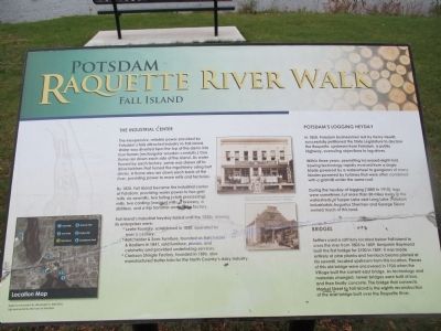
The Industrial Center
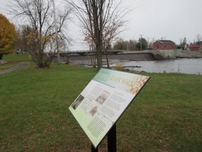
The inexpensive, reliable power provided by Potsdam's falls attracted industry to Fall Island. Water was diverted from the top of the dams into flour flumes (rectangular wooden conduits.) One flume ran down each side of the island. As water flowed by each factory, some was drawn off to drive turbines that turned the machinery using belt drives. A flume also ran down each bank of the river, providing power to more mills and factories.
By 1820, Fall Island became the industrial center of Potsdam, providing water power to two grist mills, six sawmills, two fulling (cloth processing) mills, two carding (woolen) mills, a brewery, a distillery, and a trip hammer and scythe factory.
Fall Island's industrial heyday lasted until the 1920s. Among its enterprises were:
• Leete Foundry, established in 1820, operated for over a century.
•Batchelder & Sons Furniture, founded as Batchelder & Badlam in 1841, sold furniture, pianos, and cabinetry and provided undertaking services.
•Clarkson Shingle Factory, founded in 1886, also manufactured butter tubs for the North Country's dairy industry.
(above) The Sweetser & Son shirt factory and staff on Fall Island (below) The Leete Foundry on Fall Island. Courtesy of the Potsdam Museum [both images]
Potsdam's Logging Heyday
In 1850, Potsdam businessmen led by Henry Hewitt, successfully petitioned the State Legislature to declare the Raquette, upstream from Potsdam, a public highway, overruling objections to log drives.
Within three years, sawmilling increased eight-fold. Sawing technology rapidly evolved from a single blade powered by a waterwheel to gangsaws of many blades powered by turbines that were often combined with a gristmill under the same roof.
During the heyday of logging (1880 to 1910), logs were sometimes cut more that 50 miles away in the watersheds of Tupper Lake and Long Lake. Potsdam industrialists Augustus Sherman and George Sisson owned much of this land.
Bridges
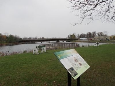
Settlers used a raft ferry located below Fall Island to cross the river from 1803 to 1809. Benjamin Raymond built the first bridge for $100 in 1809. It was made entirely of pine planks and hemlock beams planed at his sawmill, located upstream from this location. Pieces of this old bridge were uncovered in 1924 when the Village built the current east bridge. As technology and materials changed, newer bridges were built of iron, and then finally concrete. The bridge that connects Market Street to Fall Island is the eighth reconstruction of the east bridge built over the Raquette River.
Topics. This historical marker is listed in these topic lists: Bridges & Viaducts
• Industry & Commerce. A significant historical year for this entry is 1820.
Location. 44° 40.124′ N, 74° 59.373′ W. Marker is in Potsdam, New York, in St. Lawrence County. Marker is on Island Street, 0.2 miles north of Maple Street, on the right when traveling north. Marker is beyond the end of Island Street. There is public parking on Island Street. Touch for map. Marker is in this post office area: Potsdam NY 13676, United States of America. Touch for directions.
Other nearby markers. At least 8 other markers are within walking distance of this marker. James McCormick (about 300 feet away, measured in a direct line); Potsdam Raquette River Walk - Hydro Site (about 400 feet away); They Live with Us in Grateful Memory of their Sacrifice (approx. 0.2 miles away); St. Lawrence Academy (approx. ¼ mile away); The Clarkson-Knowles Cottage (approx. 0.3 miles away); Potsdam Fire Department Members Who Served in World War II (approx. 0.3 miles away); Town of Potsdam (approx. 0.3 miles away); Crane Institute (approx. half a mile away). Touch for a list and map of all markers in Potsdam.
More about this marker. Although the east bridges are described on the marker, it overlooks the west branch around the island. Refer to the other two Potsdam Raquette Riverwalk markers for the east bridge view.
Credits. This page was last revised on June 16, 2016. It was originally submitted on November 16, 2014, by Anton Schwarzmueller of Wilson, New York. This page has been viewed 401 times since then and 16 times this year. Photos: 1. submitted on November 16, 2014, by Anton Schwarzmueller of Wilson, New York. 2, 3, 4. submitted on November 17, 2014, by Anton Schwarzmueller of Wilson, New York. • Bill Pfingsten was the editor who published this page.


