Near Blue Rapids in Marshall County, Kansas — The American Midwest (Upper Plains)
Alcove Springs & the Oregon Trail
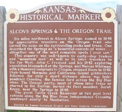
Six miles northwest is Alcove Springs, named in 1846 by appreciative travelers on the Oregon trail who carved the name on the surrounding rocks and trees. One described the Springs as "a beautiful cascade of water... altogether one of the most romantic spots I ever saw."
This country was well-known to early-day traders and "mountain men" as well as to later travelers to the Far West. John C. Fremont and his 1842 exploring expedition bivouacked at the Springs, and Marcus Whitman, with a thousand emigrants to Oregon, stopped there in 1843. Utah-bound Mormons and California-bound goldseekers followed, for only a short distance above was Independence Crossing, the famous ford across the Big Blue river. The Donner party, most of whom later froze or starved in the Sierras, buried its first member, Sarah Keyes, near the Springs in 1846.
The great Tuttle Creek Reservoir at full pool level extends along the Big Blue from Independence Crossing southward nearly to Manhattan.
Erected by Kansas Historical Society and State Highway Commission. (Marker Number 26.)
Topics and series. This historical marker is listed in these topic lists: Environment • Exploration • Roads & Vehicles • Waterways & Vessels. In addition, it is included in the California Trail, the Kansas Historical Society, and the Oregon Trail series lists. A significant historical year for this entry is 1846.
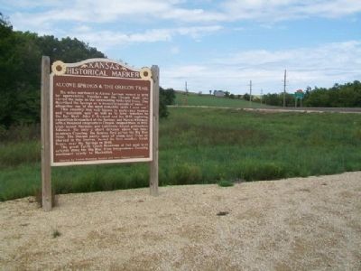
Location. 39° 41.329′ N, 96° 38.063′ W. Marker is near Blue Rapids, Kansas, in Marshall County. Marker is on Valley Road (State Highway 9) 0.1 miles east of U.S. 77, on the right when traveling east. Touch for map. Marker is in this post office area: Blue Rapids KS 66411, United States of America. Touch for directions.
Other nearby markers. At least 8 other markers are within 2 miles of this marker, measured as the crow flies. Oldest Roundabout in Kansas (approx. 1.3 miles away); Blue Rapids Public Library (approx. 1.4 miles away); Blue Rapids Station Bell (approx. 1.4 miles away); War Memorial (approx. 1.4 miles away); Gigantic Glaciers (approx. 1.4 miles away); Oldest Rocks in Kansas (approx. 1.4 miles away); Ice Age (approx. 1.4 miles away); Historic Holm Cabin (approx. 1.4 miles away). Touch for a list and map of all markers in Blue Rapids.
Also see . . .
1. Alcove Spring National Register Nomination (Amendment).
(Submitted on November 23, 2014, by William Fischer, Jr. of Scranton, Pennsylvania.)
2. Oregon National Historic Trail. (Submitted on November 23, 2014, by William Fischer, Jr. of Scranton, Pennsylvania.)
Credits. This page was last revised on June 16, 2016. It was originally submitted on November 23, 2014, by William Fischer, Jr. of Scranton, Pennsylvania. This page has been viewed 523 times since then and 21 times this year. Photos: 1, 2. submitted on November 23, 2014, by William Fischer, Jr. of Scranton, Pennsylvania.

