Canton in St. Lawrence County, New York — The American Northeast (Mid-Atlantic)
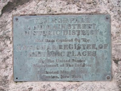
Village Park and Main Street
Erected 1984.
Topics. This historical marker is listed in this topic list: Notable Places. A significant historical date for this entry is May 28, 1984.
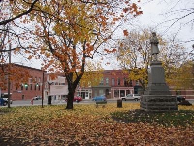
Location. 44° 35.732′ N, 75° 10.118′ W. Marker is in Canton, New York, in St. Lawrence County. Marker is at the intersection of East Main Street (U.S. 11) and Park Street (County Route 27), on the right when traveling east on East Main Street. Plaque is on a stone facing US 11 between the intersection and the WWI & WWII memorial. Touch for map. Marker is in this post office area: Canton NY 13617, United States of America. Touch for directions.
Other nearby markers. At least 8 other markers are within walking distance of this marker. In Memoriam (a few steps from this marker); In Memory of those Citizens from the Town of Canton (a few steps from this marker); Home of Silas Wright (within shouting distance of this marker); Town Hall (about 700 feet away, measured in a direct line); Rushton Boat Shop (approx. ¼ mile away); Silas Wright (approx. ¼ mile away); Water Street and the Third Dam (approx. ¼ mile away); The King Iron Bowstring Bridge (approx. 0.3 miles away). Touch for a list and map of all markers in Canton.
More about this marker. Canton Village Park also includes the Civil War memorial.
Regarding Village Park and Main Street. According to Wikipedia, it was registered in 1975 and its boundaries were increased in 1983 and 2008.
Also see . . . Village Park Historic District - National Archives. National Register of Historic Places documentation (Submitted on October 23, 2023, by Anton Schwarzmueller of Wilson, New York.)
Credits. This page was last revised on October 23, 2023. It was originally submitted on November 23, 2014, by Anton Schwarzmueller of Wilson, New York. This page has been viewed 286 times since then and 13 times this year. Photos: 1, 2, 3, 4. submitted on November 23, 2014, by Anton Schwarzmueller of Wilson, New York. • Bill Pfingsten was the editor who published this page.


