Abilene in Jones County, Texas — The American South (West South Central)
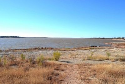
Lake Fort Phantom Hill Parks - Johnson Park
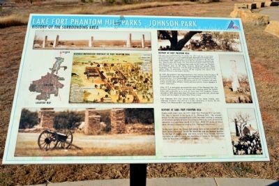
History of Fort Phantom Hill
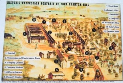
The post was established on November 14, 1851 and just a year later was transformed into a well-organized and thoroughly developed post. However, conditions continued to be difficult for people at the fort, and in November 1853, approval was given for the military to abandon the fort. Shortly after the troops left, fire destroyed most of the log walls and thatch roofs of the buildings that made up this large and complex five-company post on the Texas Frontier. However, several stone buildings, stone chimneys, and the stone building foundations remain intact today. A watercolor portrait of the original fort shows Fort Phantom Hill as it was before the fire.
In 1858, the property was reoccupied as a way station on the Southern Overland Mail route and the Butterfield Stagecoach set up a stop at the abandoned fort. Fort Phantom Hill was used again during the Civil War by the Confederacy’s Frontier Battalion, and in 1871 became a sub-post of Fort Griffin (near Albany, Texas) and was used by troops engaged in Indian campaigns.
After 1875, a town grew up around the ruins of Fort Phantom Hill. The location functioned first as a buying and shipping point for buffalo hides and eventually as a town of more than 500 residents. Census records in 1880 show more than 545 people living at the fort, which had a hotel and the staples of most West Texas towns.
Fort Phantom Hill also served briefly as the Jones County seat, although residents later moved it to the community of Anson. By the 1890s, Fort Phantom Hill was largely abandoned.
History of Lake Fort Phantom Hill
Eighty-eight years later, in 1939, Lake Fort Phantom Hill was built. The lake is located on the south of Ft. Phantom Hill. The original design for the lake consisted of a 6,600 foot dam, holding a capacity of 24 billion gallons of water, covering 4,200 acres, with 29 miles of shoreline to a maximum depth of 65 feet. With 395 miles of water shed, the main tributaries are Big Elm, Elm and Cedar Creek.
In the early years, the houses and cabins built on lots around the lake were mostly occupied during the weekends and the summer months. In the last 25 years, more and more people have become full-time residents in order to enjoy the amenities of living by the water along with the beautiful sunrises and sunsets.
Source: www.fortphantom.org and the Lake Fort Phantom Hill Neighborhood Assoc.
Topics. This historical marker is listed in these topic lists: Communications • Forts and Castles • Settlements & Settlers. A significant historical month for this entry is November 1812.
Location. 32° 36.761′ N, 99°
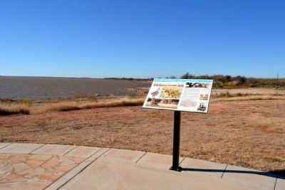
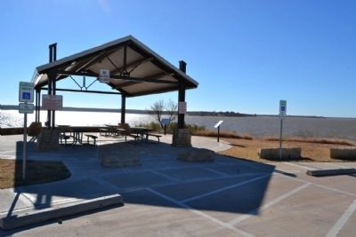
40.733′ W. Marker is in Abilene, Texas, in Jones County. Marker can be reached from Farm to Market Road 1082, half a mile east of Farm to Market Road 600. Marker is located at the north end of Lake Fort Phantom Hill in Johnson Park next to Pavilion 2; the above directions are to the park entrance. Touch for map. Marker is in this post office area: Abilene TX 79601, United States of America. Touch for directions.
Other nearby markers. At least 8 other markers are within 10 miles of this marker, measured as the crow flies. Fort Phantom Hill (approx. 2.1 miles away); a different marker also named Fort Phantom Hill (approx. 2.1 miles away); Round Mound Cemetery (approx. 3.2 miles away); Butterfield Trail (approx. 7.3 miles away); Site of Old Headquarters of the Hashknife Ranch (approx. 9.9 miles away); Hardin-Simmons University Campus Triangle (approx. 10 miles away); Hardin-Simmons University (approx. 10 miles away); The Hardin-Simmons Bell (approx. 10 miles away). Touch for a list and map of all markers in Abilene.
Also see . . . Fort Phantom Hill - The Handbook of Texas. From the Texas State Historical Association’s “Handbook of Texas Online”. (Submitted on December 2, 2014.)
Credits. This page was last revised on October 23, 2021. It was originally submitted on December 2, 2014, by Duane Hall of Abilene, Texas. This page has been viewed 641 times since then and 43 times this year. Photos: 1, 2, 3, 4, 5. submitted on December 2, 2014, by Duane Hall of Abilene, Texas.
