Morrill in Scotts Bluff County, Nebraska — The American Midwest (Upper Plains)
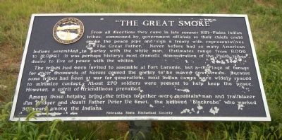
“The Great Smoke”
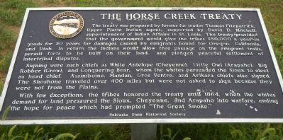
The Horse Creek Treaty
From all directions they came in late summer 1851 - Plains Indian tribes, summoned by government officials so their chiefs could smoke the peace pipe and sign a treaty with representatives of “The Great Father.” Never before had so many American Indians assembled to parley with the white man. (Estimates range from 8,000 to 12,000.) It was perhaps history’s most dramatic demonstration of the Plain’s tribes desire to live at peace with the whites.
The tribes had been invited to assemble at Fort Laramie, but a shortage of forage for their thousands of horses caused the parley to be moved downstream. Because some tribes had been at war for generations, most Indian camps widely spaced to minimize contact. About 270 soldiers were present to help keep the peace. However, a spirit of friendliness prevailed.
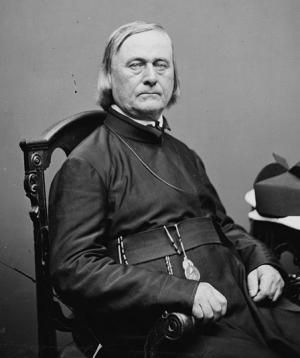
Among those helping bring the tribes together were mountain man and trailblazer Jim Bridger and Jesuit Father Peter De Smet, the beloved “Blackrobe” who worked 50 years among the Indians.
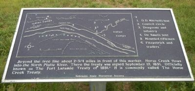
Beyond the tree line about 2 3/4 miles in front of this marker, Horse Creek flows into the North Platte River. There the treaty was signed September 17, 1851. Officially known as The Forty Laramie Treaty of 1851, it is commonly called The Horse Creek Treaty.
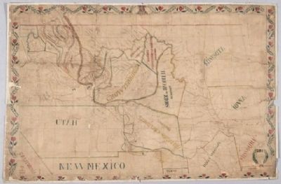
Legend: 1. D.D. Mitchell’s tent; 2. Council circle; 3. Dragoons and infantry; 4. De Smet’s tent; 5. Mounted riflemen; 6. Fitzpatrick and traders.
The Treaty was proposed by former fur trader Thomas Fitzpatrick, Upper Platte Indian agent, supported by David D. Mitchell, superintendent of Indian Affairs in St. Louis. The treaty provided that the government would give there tribes $50,000 a year in goods for 50 years for damage caused by emigrants bound for Oregon, California and Utah. In return the Indians would allow free passage on the emigrant trails, permit forts to be built on their land, and pledged peaceful settlement of intertribal disputes.
Signing were such chiefs as White Antelope (Cheyenne), Little Owl (Arapaho), Big Robber (Crow), and Conquering Bear, whom the whites persuaded the Sioux to elect as head chief. Assiniboine, Mandan, Gros Ventre, and Arikara chiefs also signed. The Shoshone traveled over 400 miles but were not asked to sign because they were not from the Plains.
With few exceptions, the tribes honored the treaty until 1864, when the whites demand for land pressured the Sioux, Cheyenne, and Arapaho into warfare, ending the hope for peace which had prompted “The Great Smoke.”
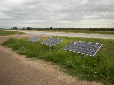
Erected by Nebraska State Historical Society. (Marker Number 369 A & B.)
Topics and series. This historical marker is listed in these topic lists: Native Americans • Wars, US Indian. In addition, it is included in the Nebraska State Historical Society series list. A significant historical date for this entry is September 17, 1766.
Location. 41° 58.341′ N, 104° 0.547′ W. Marker is in Morrill, Nebraska, in Scotts Bluff County. Marker is on U.S. 26 near County Route 4, on the left when traveling west. Touch for map. Marker is in this post office area: Morrill NE 69358, United States of America. Touch for directions.
Other nearby markers. At least 8 other markers are within 11 miles of this marker, measured as the crow flies. The Road to Zion (within shouting distance of this marker); Oregon Trail (approx. 2.1 miles away); a different marker also named The Oregon Trail (approx. 3.2 miles away in Wyoming); Stuart’s 1812-13 Astorian Party Campsite (approx. 6.6 miles away in Wyoming); a different marker also named Oregon Trail (approx. 10.1 miles away in Wyoming); Cold Springs (approx. 10.1 miles away in Wyoming); Empire, Wyoming: African American Community Building in the West (approx. 10.4 miles away in Wyoming); a different marker also named Oregon Trail (approx. 10.4 miles away in Wyoming).
