Niagara Falls in Niagara Region, Ontario — Central Canada (North America)
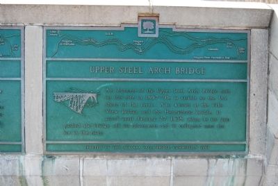
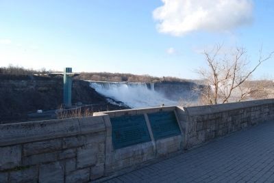
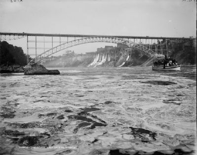
Upper Steel Arch Bridge
Erected 1989 by Niagara Falls Bridge Commission.
Topics. This historical marker is listed in this topic list: Bridges & Viaducts. A significant historical date for this entry is January 27, 1892.
Location. 43° 5.425′ N, 79° 4.244′ W. Marker is in Niagara Falls, Ontario, in Niagara Region. Marker can be reached from the intersection of River Road and Clifton Hill, on the right when traveling north. Touch for map. Marker is in this post office area: Niagara Falls ON L2G 3K9, Canada. Touch for directions.
Other nearby markers. At least 8 other markers are within walking distance of this marker. Upper Suspension Bridge (here, next to this marker); Thomas Baker McQuesten (about 120 meters away, measured in a direct line); Rainbow Bridge (about 120 meters away); International Rainbow Bridge Commemoration (about 150 meters away); The Boundary Waters Treaty (approx. 0.3 kilometers away); To the Memory of Burrell Hecock (approx. 0.3 kilometers away); Zimmerman Fountain Pond (approx. 0.3 kilometers away); The Falls View Bridges (approx. 0.4 kilometers away in the U.S.). Touch for a list and map of all markers in Niagara Falls.
Related marker. Click here for another marker that is related to this marker.
Additional commentary.
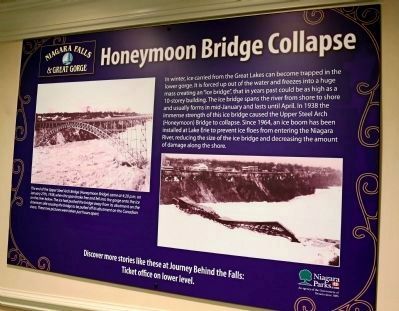
1. Text of Poster shown in Photo No. 3.
Honeymoon Bridge Collapse. In winter, ice carried from the Great Lakes can become trapped in the lower gorge. It is forced up out of the water and freezes into a huge mass creating an “ice bridge,” that in years past could be as high as a 10-storey building. The ice bridge spans the river from shore to shore and usually forms in mid-January and lasts until April. In 1938 the immense strength of this ice bridge caused the Upper Steel Arch (Honeymoon) Bridge to collapse. Since 1964, an ice boom has been installed at Lake Erie to prevent ice floes from entering the Niagara River, reducing the size of the ice bridge and decreasing the amount of damage along the shore.
Photograph
caption. The end of the Upper Steel Arch Bridge (Honeymoon Bridge) came at 4:20 p.m. on January 27, 1938, when the span broke free and fell into the gorge onto the ice on the river below. The ice had pushed the bridge away from its abutment on the American side, causing the bridge to be pulled off its abutment on the Canadian shore. These two pictures were taken just hours apart.
— Submitted December 21, 2014.
Credits. This page was last revised on September 27, 2019. It was originally submitted on April 22, 2013, by Mike Wintermantel of Pittsburgh, Pennsylvania. This page has been viewed 693 times since then and 27 times this year. Last updated on December 9, 2014, by Anton Schwarzmueller of Wilson, New York. Photos: 1, 2. submitted on April 22, 2013, by Mike Wintermantel of Pittsburgh, Pennsylvania. 3. submitted on December 21, 2014, by J. J. Prats of Powell, Ohio. 4. submitted on April 22, 2013. • Bill Pfingsten was the editor who published this page.


