Alexander in Burke County, Georgia — The American South (South Atlantic)
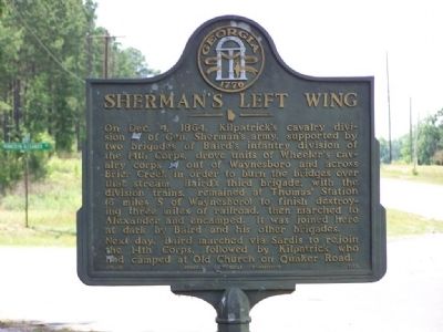
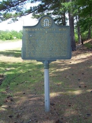
Sherman's Left Wing
Next day, Baird marched via Sardis to rejoin the 14th Corps, followed by Kilpatrick who had camped at Old Church on Quaker Road.
Erected 1958 by Georgia Historical Commission. (Marker Number 017-17.)
Topics and series. This historical marker is listed in this topic list: War, US Civil. In addition, it is included in the Georgia Historical Society, and the Sherman’s March to the Sea series lists. A significant historical date for this entry is December 4, 1864.
Location. 33° 1.318′ N, 81° 52.594′ W. Marker is in Alexander, Georgia, in Burke County. Marker is at the intersection of Old Quaker Road (State Highway 24) and Munnerlyn-Alexander Road, on the right when traveling east on Old Quaker Road. Touch for map. Marker is in this post office area: Waynesboro GA 30830, United States of America. Touch for directions.
Other nearby markers. At least 8 other markers are within 10 miles of this marker, measured as the crow flies. Botsford Church - 1773 (approx. 5.4 miles away); Original Site Sardis Baptist Church (approx. 6.7 miles away); The 14th Corps at Lumpkin's Station (approx. 6.9 miles away); Sardis Baptist Church (approx. 7.7 miles away); Colonels Twiggs and Few (approx. 8˝ miles away); Old Quaker Road (approx. 8.6 miles away); The Cavalry Actions at Waynesboro (approx. 8.6 miles away); The J.D. Roberts Home (approx. 9.3 miles away).
Related marker. Click here for another marker that is related to this marker. To understand the relationship, study marker
Also see . . . Brier Creek's Past History. The Battle of Brier Creek was an American Revolutionary War battle fought near the joining of Brier Creek with the Savannah River in eastern Georgia. (Submitted on May 26, 2008, by Mike Stroud of Bluffton, South Carolina.)
Credits. This page was last revised on April 29, 2019. It was originally submitted on May 26, 2008, by Mike Stroud of Bluffton, South Carolina. This page has been viewed 2,452 times since then and 28 times this year. Photos: 1, 2. submitted on May 26, 2008, by Mike Stroud of Bluffton, South Carolina. • Craig Swain was the editor who published this page.

