Near Fort Laramie in Goshen County, Wyoming — The American West (Mountains)
Spanning a Century: End of an Era
Inscription.
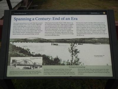
Once broad and turbulent, the North Platte River posed a formidable obstacle to 19th century travelers. High water made it nearly impossible to cross the river for several months each year. The crossing became less dangerous by 1850 when ferry service was established to meet the growing volume of military and emigrant traffic. Frequent ferry accidents and slow crossing speeds continued to impede travelers until a permanent bridge was built.
Following the Fort Laramie Treaty of 1868, which set up the “Great Sioux Reservation,” huge amounts of supplies were needed to provision the newly established Indian agencies. Businessmen in Cheyenne quickly recognized the lucrative opportunities. To insure that the supply route between Cheyenne and the agencies remained the most practical one, Wyoming Congressman, W.R. Steele convinced Congress to fund the construction of a bridge across the North Platte River.
The discovery of gold in the Black Hills led thousands of fortune hunters to cross the Fort Laramie Bridge into the Great Sioux Reservation, in violation of the Treaty of 1868. Efforts to negotiate with the Lakota to sell the Black Hills failed, resulting in open warfare in 1876. The military used the bridge to move troops and supplies needed to engage the Northern Plains Nations. Ultimately, the tribes were subjugated and their lands taken. It was the end of a way of life and an era.
The King Iron Bowstring Bridge
At the dawn of the new century, motor vehicles rapidly replaced wagons and stagecoaches as the primary conveyance on the bridge. The bridge continued to be used until 1958 and was donated to the National Park Service in 1961.
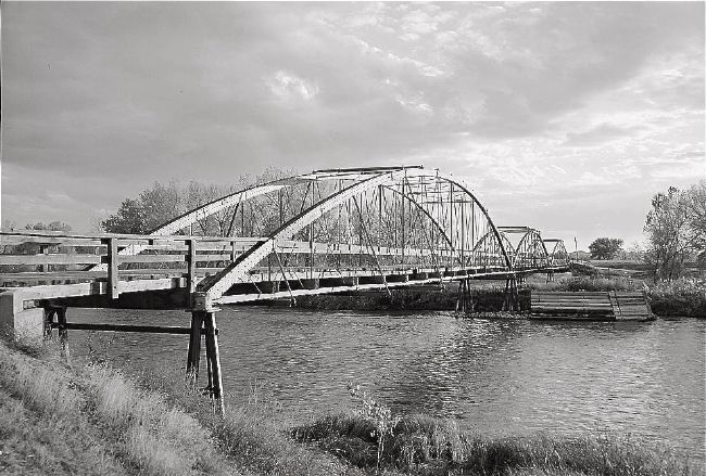
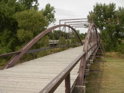
The King Iron Bridge Company built bridges with speed and efficiency by standardizing the manufacturing process and maintaining stockpiles of prefabricated parts. The triple-span Fort Laramie Bridge was constructed between August 1875 and February 1876 for $15,000. Rubble filled , log ice breakers protected the unique I-beam piers supporting the bridge. Spanning 400 feet, this bridge is the best-preserved King patent tubular bowstring bridge sill in existence.
Erected by National Park Service, U.S. Department of the Interior.
Topics. This historical marker is listed in these topic lists: Bridges & Viaducts • Forts and Castles. A significant historical month for this entry is February 1876.
Location. 42° 12.578′ N, 104° 32.046′ W. Marker is near Fort Laramie, Wyoming, in Goshen County. Marker is on State Highway 160 near County Route 59, on the left when traveling west. Touch for map. Marker is in this post office area: Fort Laramie WY 82212, United States of America. Touch for directions.
Other nearby markers. At least 8 other markers are within 2 miles of this marker, measured as the crow flies. Old Army Bridge Over the Platte River (about 500 feet away, measured in a direct line); Fort Platte (approx. 0.2 miles away); Fort Laramie National Historic Site (approx. 0.7 miles away); Mormon Pioneers at Fort Laramie (approx. 0.9 miles away); The Cavalry Stables (approx. 1.2 miles away); Handcarts – The New Plan (approx. 1.2 miles away); Post Quartermaster’s Area (approx. 1.2 miles away); Noncommissioned Officers’ Quarters (approx. 1.2 miles away). Touch for a list and map of all markers in Fort Laramie.
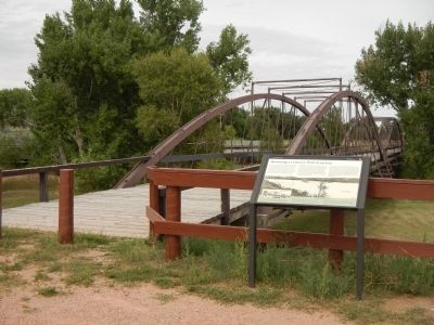
More about this marker. This marker is located at the west end of the old bridge.

Photographed By Jack Boucher, 1974
4. Bridge from north east. - North Platte River Bowstring Truss Bridge…
Photo courtesy of the Historic American Buildings Survey. From the Survey: Significance: The North Platte River Bowstring Truss Bridge is the first of its kind to be built in the then territory of Wyoming. It is also believed to be the first military bridge west of the Mississippi.
Credits. This page was last revised on September 26, 2020. It was originally submitted on December 19, 2014, by Barry Swackhamer of Brentwood, California. This page has been viewed 426 times since then and 10 times this year. Photos: 1, 2, 3. submitted on December 19, 2014, by Barry Swackhamer of Brentwood, California. 4. submitted on December 21, 2014. • Andrew Ruppenstein was the editor who published this page.


