Near Fredericksburg in Spotsylvania County, Virginia — The American South (Mid-Atlantic)
Engines of Destruction
The Battle of Fredericksburg
— Fredericksburg and Spotsylvania National Military Park —
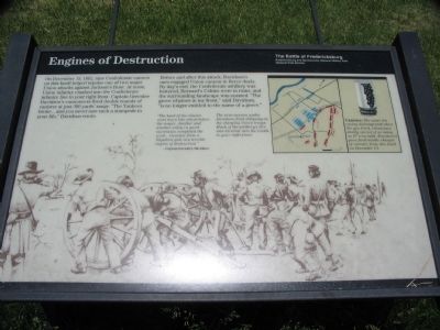
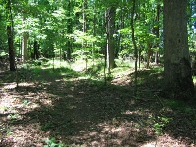
On December 13, 1862, nine Confederate cannon on this knoll helped repulse one of two major Union attacks against Jackson's front. At noon, Union infantry crashed into the Confederate infantry line to your right-front. Captain Greenlee Davidson's cannoneers fired double rounds of canister at just 300 yards' range. "The Yankees broke ... and you never saw such a stampede in your life," Davidson wrote.
Before and after this attack, Davidson's men engaged Union cannon in fierce duels. By day's end, the Confederate artillery was battered, Bernard's Cabins were in ruins, and the surrounding landscape was scarred. "The grove of pines in my front," said Davidson, "is no longer entitled to the name of a grove."
"The head of the column went down like wheat before the reaper. Another and another volley in quick succession completed the work...Canister from a Napoleon gun is a terrible engine of destruction."
-Captain Greenlee Davidson.
Erected by National Park Service, U.S. Department of the Interior.
Topics. This historical marker is listed in this topic list: War, US Civil. A significant historical month for this entry is December 1860.
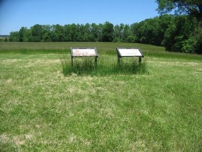
Location. 38° 15.587′ N, 77° 27.258′ W. Marker is near Fredericksburg, Virginia, in Spotsylvania County. Marker can be reached from Lee Drive, on the right when traveling east. Marker is located along the Bernard's Cabins walking trail off Lee Drive in the Fredericksburg-Spotyslvania Military Park. The most convenient access is from Lansdowne Road. Touch for map. Marker is in this post office area: Fredericksburg VA 22408, United States of America. Touch for directions.
Other nearby markers. At least 8 other markers are within walking distance of this marker. Bernard's Cabins (here, next to this marker); Slaughter Pen Farm (approx. ¼ mile away); a different marker also named Slaughter Pen Farm (approx. 0.3 miles away); a different marker also named Slaughter Pen Farm (approx. 0.4 miles away); a different marker also named Slaughter Pen Farm (approx. half a mile away); a different marker also named Slaughter Pen Farm (approx. half a mile away); Riverside Plantation: Mannsfield (approx. half a mile away); Bernard's Cabin Trail (approx. half a mile away). Touch for a list and map of all markers in Fredericksburg.
More about this marker. The background of the marker is a drawing of artillery crew working their guns, captioned: The nine cannon under Davidson fired obliquely on the charging Union troops. Much of the artillery's fire was directed into the woods to your right-front.
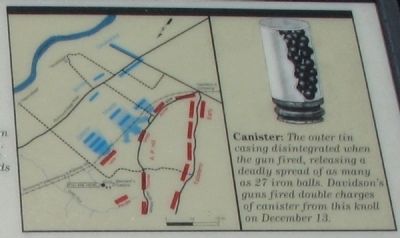
To the upper right is a map illustrating the tactical situation described in the text. A drawing of a canister round is detailed, The outer tin casing disintegrated when the gun fired, releasing a deadly spread of as many as 27 iron balls. Davidson's guns fired double charges of canister from this knoll on December 13.
Credits. This page was last revised on February 2, 2023. It was originally submitted on May 27, 2008, by Craig Swain of Leesburg, Virginia. This page has been viewed 1,753 times since then and 25 times this year. Last updated on January 6, 2023, by Bradley Owen of Morgantown, West Virginia. Photos: 1, 2, 3, 4, 5. submitted on May 27, 2008, by Craig Swain of Leesburg, Virginia. • J. Makali Bruton was the editor who published this page.
