Middle Branch Park in Baltimore, Maryland — The American Northeast (Mid-Atlantic)
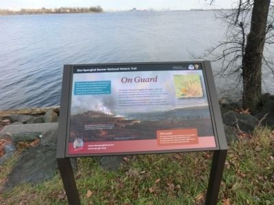
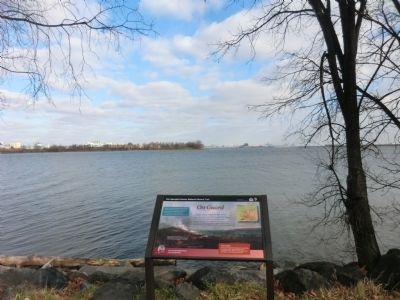
On Guard
Star-Spangled Banner National Historic Trail
— National Park Service, U.S. Department of the Interior —
Three gun batteries hugging the upper shore of Ferry Branch guarded the west flank of Fort McHenry. They included the makeshift earthworks of Fort Babcock, the incomplete Fort Covington, and a temporary redoubt at Ferry Point.
During the bombardment of Fort McHenry on September 13-14, 1814, these Ferry Branch fortifications stopped a surprise British maneuver to attack Fort McHenry from the less well-defended rear.
Aftermath
This close call exposed Fort McHenry’s vulnerability to a flanking attack. The fortifications were strengthened and a defensive boom added across Ferry Branch in case the enemy returned.
"About one in the morning the British passed several of their vessels above the Fort and near to town, but providently they were met by the fire of …marine battery."
Eyewitness account in Salem (MA) Gazette, September 27, 1814.
[Caption:]
Two of the Ferry Branche fortifications show in this 1829 painting by Alfred Jacob Miller. Fort Babcock is right of center, Fort Covington is at far right.
Erected by National Park Service, U.S. Department of the Interior.
Topics and series. This historical marker is listed in this topic list: War of 1812 . In addition, it is included in the Star Spangled Banner National Historic Trail series list. A significant historical month for this entry is September 1863.
Location. 39° 15.3′ N, 76° 36.918′ W. Marker is in Baltimore, Maryland. It is in Middle Branch Park. Marker is on Waterview Avenue. The marker is located in Broening Park. Touch for map. Marker is at or near this postal address: 2801 S Hanover St, Brooklyn MD 21225, United States of America. Touch for directions.
Other nearby markers. At least 8 other markers are within walking distance of this marker. John Smith Explores Patapsco (within shouting distance of this marker); Maryland Vietnam Veterans Memorial (about 400 feet away, measured in a direct line); Hippocrates' Platanus (Sycamore) (approx. 0.2 miles away); Gwynns Falls Trail (approx. 0.3 miles away); Senator Harry McGuirk (approx. 0.3 miles away); A River that Shaped a City (approx. 0.4 miles away); River, Industry, & Community (approx. 0.4 miles away); a different marker also named Gwynns Falls Trail (approx. 0.4 miles away). Touch for a list and map of all markers in Baltimore.
Credits. This page was last revised on April 6, 2023. It was originally submitted on December 21, 2014, by Don Morfe of Baltimore, Maryland. This page has been viewed 831 times since then and 13 times this year. Photos: 1, 2. submitted on December 21, 2014, by Don Morfe of Baltimore, Maryland. • Bill Pfingsten was the editor who published this page.

