Wintersville in Jefferson County, Ohio — The American Midwest (Great Lakes)
Wintersville
Two Ridges Church and Friendly Fire
— John Hunt Morgan Heritage Trail —
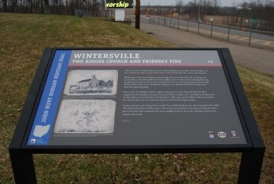
Working their way toward Wintersville through the area south of here, the Confederates ran into the scouts of the Jefferson County militia. Several volleys were exchanged, leaving a militiaman dead and a local woman wounded. The Confederates quickly passed through Wintersville on the way to Richmond. Morgan's men advised inhabitants to take cover from the impending fight.
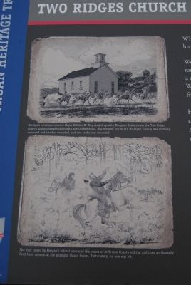
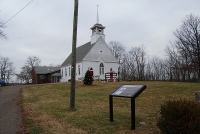
Here, at the Two Ridges Church, regular Union forces under Major William B. Way caught up with Morgan's rear units. Several of Way's troopers were wounded in the skirmish. As the militia commanded by Colonel James Collier came up the hill from the east toward the church, their view was obstructed by dust raised by Morgan's troops.
At the same time, the Union forces under General Shackelford were advancing from the south. The militia filled their artillery piece with scrap iron and fired it, but they mistakenly raked the Union line. The confusion was soon straightened out, but it gave Morgan and his men a lead to the north.
Erected 2013 by the Ohio Department of Transportation, the Ohio History Connection, and the Ohio Civil War Trail Commission. (Marker Number 49.)
Topics and series. This historical marker is listed in these topic lists: Churches & Religion • War, US Civil. In addition, it is included in the John Hunt Morgan Heritage Trail in Ohio series list. A significant historical month for this entry is July 1837.
Location. 40° 23.666′ N, 80° 43.755′ W. Marker is in Wintersville, Ohio, in Jefferson County. Marker can be reached from the intersection of Canton Road (Ohio Route 43) and Two Ridges Road. Touch for map. Marker is in this post office area: Steubenville OH 43953, United States of America. Touch for directions.
Other nearby markers. At least 8 other markers are within 7 miles of this marker, measured as the crow flies. Morgan's Raid (here, next to this marker); John D. Kilgore (within shouting distance of this marker); a different marker also named Morgan's Raid (approx. 2.1 miles away); a different marker also named Morgan's Raid (approx. 3.4 miles away); Ohio River Lock and Dam 10 Site (approx. 6.1 miles away); a different marker also named Morgan's Raid (approx. 6.3 miles away); Tuskegee Airmen in WWII (approx. 6.4 miles away); Andrew Carnegie (1835-1919) / Carnegie Library of Steubenville (approx. 6˝ miles away). Touch for a list and map of all markers in Wintersville.

Photographed By Mike Wintermantel, December 21, 2014
2. Wintersville Marker
Top Photo
Michigan cavalrymen under Major William B. Way caught up with Morgan's Raiders near the Two Ridges Church and exchanged shots with the Confederates. One member of the 9th Michigan Cavalry was mortally wounded and another wounded, and one raider was wounded.
Bottom Photo
The dust raised by Morgan's retreat obscured the vision of Jefferson County militia, and they accidently fired their cannon at the pursuing Union troops. Fortunately, no one was hit.
Credits. This page was last revised on September 13, 2017. It was originally submitted on December 21, 2014, by Mike Wintermantel of Pittsburgh, Pennsylvania. This page has been viewed 701 times since then and 35 times this year. Photos: 1, 2, 3. submitted on December 21, 2014, by Mike Wintermantel of Pittsburgh, Pennsylvania.

