Deersville in Harrison County, Ohio — The American Midwest (Great Lakes)
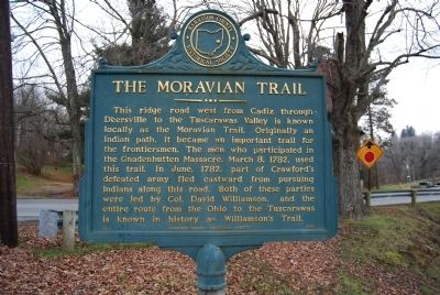
The Moravian Trail
Erected 1964 by Harrison County Historical Society. (Marker Number 1.)
Topics. This historical marker is listed in these topic lists: Native Americans • Roads & Vehicles. A significant historical date for this entry is March 8, 1782.
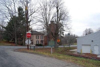
Location. 40° 18.473′ N, 81° 11.225′ W. Marker is in Deersville, Ohio, in Harrison County. Marker is at the intersection of Main Street and Mallarnee Road, on the right when traveling west on Main Street. Located at Deersville VFD. Touch for map. Marker is in this post office area: Deersville OH 44693, United States of America. Touch for directions.
Other nearby markers. At least 8 other markers are within 8 miles of this marker, measured as the crow flies. Deersville (within shouting distance of this marker); Hazel's House (approx. 0.2 miles away); Moravian House (approx. 0.2 miles away); Mary L. Jobe Akeley / Harry F. Hazlett (approx. ¼ mile away); Laceyville (approx. 3.2 miles away); Tappan (approx. 3.4 miles away); The Seven Ranges (approx. 3.8 miles away); Moorefield (approx. 7.7 miles away). Touch for a list and map of all markers in Deersville.
Related markers. Click here for a list of markers that are related to this marker. To better understand the relationship, study each marker in the order shown.
Additional commentary.
1. Marker
This marker was originally 1.6 miles east of town. It was moved in the early 90's
— Submitted December 1, 2016, by Adam Woodward of Cadiz, Ohio.
Credits. This page was last revised on September 28, 2017. It was originally submitted on December 21, 2014, by Mike Wintermantel of Pittsburgh, Pennsylvania. This page has been viewed 1,740 times since then and 226 times this year. Photos: 1, 2. submitted on December 21, 2014, by Mike Wintermantel of Pittsburgh, Pennsylvania.

