Near Guernsey in Platte County, Wyoming — The American West (Mountains)
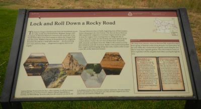
Lock and Roll Down a Rocky Road
The trail followed a line of bluffs, beginning west of Fort Laramie, before dropping to the river bottom. The descent down Mexican Hill required the emigrants to lock their wagon wheels in order to keep the wagons from running away or rolling into the ox teams. Once they made it to the bottom, the route opened up for a short distance before the river forced them back toward the cliffs. Journals and diaries from the 1840s & 1850s remind us of the determination and will of pioneer families who pushed and pulled their wagons and belongings along this rocky road in order to start a new life on the American frontier.
(Side-bar on the lower right)
Mexican Hill
The steep, rocky descent, known as Mexican Hill, acquired its name from a group of Mexican settlers living along the river plain below . In the early 1840s, they constructed an irrigation system along the river flats to water their vegetable gardens. The often traded a variety of these vegetables with the emigrants and soldiers passing through the area.
Thomas Bullock, June 4, 1847 - at Mexican Hill. “We had a very steep hill to descend between 4 & 5. We not only locked Wheels, but had attached ropes to the hind end of the Wagons (with) the brethren holding back at the same time. In about 2 hours we got safely thro’ 7 halt for the night at 5:20 in the bottom, near the River, having traveled 8 1/4 miles. A thunder shower passing over at the time from the North directly afterwards and we saw two perfect rainbows in the heavens and an Eagle flying in the Air…”
William Clayton, Saturday June 5th, 1847 - at Deep Hill Ruts. “ … After traveling a little over four miles we ascended a steep bluff. The road runs on the top of it a little distance in a very crooked direction, the surface in some places being hard, uneven rock, which shakes and jars the wagons very much. In one place there is a little descent and at the bottom a very sharp turn in the road over rough rock. Here Brother Crow’s cart turned over. However, it was soon righted and no injury done to anything…”
Erected by Mormon Trail Heritage Foundation & National Park Service.
Topics and series. This historical marker is listed in these topic lists: Roads & Vehicles • Settlements & Settlers. In addition, it is included in the Oregon Trail series list. A significant historical date for this entry is June 4, 1932.
Location. 42° 15.668′ N, 104° 41.818′ W. Marker is near Guernsey, Wyoming, in Platte County. Marker is on U.S. 26,, 1.2 miles east of Wyoming Highway 270, on the right when traveling east. Touch for map. Marker is in this post office area: Guernsey WY 82214, United States of America. Touch for directions.
Other nearby markers. At least 8 other markers are within 3 miles of this marker, measured as the crow flies. North Platte River (within shouting distance of this marker); Oregon Trail Memorial (approx. 1.2 miles away); Register Cliff (approx. 1.2 miles away); Register Cliff State Historic Site (approx. 1.2 miles away); Centre Star Station (approx. 1.4 miles away); Historic Guernsey Area (approx. 2.3 miles away); Guernsey War Memorial (approx. 2.3 miles away); Oregon Trail (approx. 2.3 miles away). Touch for a list and map of all markers in Guernsey.
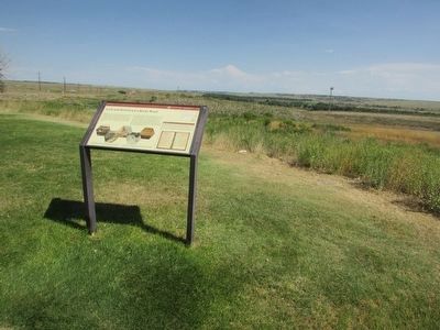
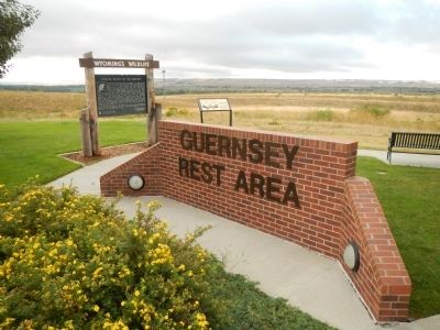
More about this marker. This marker is located at the Guernsey Rest Area.
Credits. This page was last revised on January 16, 2021. It was originally submitted on December 22, 2014, by Barry Swackhamer of Brentwood, California. This page has been viewed 518 times since then and 12 times this year. Last updated on January 16, 2021, by Craig Baker of Sylmar, California. Photos: 1. submitted on December 22, 2014, by Barry Swackhamer of Brentwood, California. 2. submitted on August 9, 2015, by Bill Coughlin of Woodland Park, New Jersey. 3. submitted on December 22, 2014, by Barry Swackhamer of Brentwood, California.


