Near Hanska in Brown County, Minnesota — The American Midwest (Upper Plains)
Lake Hanska Pioneer / Lake Hanska County Park
A Tribute to Ole Synsteby 1856 – 1942
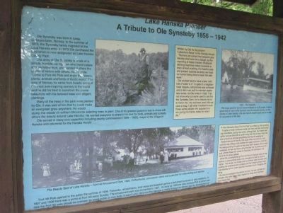
Ole Synsteby was born in Lesja, Gulbrandsdalen, Norway. In the summer of 1873, the Synsteby family migrated to the Lake Hanska area. In 1879 Ole purchased the land which is now designated as Lake Hanska County Park.
The story of Ole Synsteby is a tale of a simple, humble, caring man who loved nature and his fellow man, and wanted to share the glories of nature with others. As he wrote: "Come to Fort Hill Park and enjoy the flowers, plants, animals and birds of God's world." The area of Norway he came from boasts some of the most awe-inspiring scenery in the world and he did his best to transform the prairie lakeshore with his beloved trees and diligent plantings.
Many of the trees in the park were planted by Ole. It was said of him that he could make an evergreen grow anywhere. He would stump the woods of northern Minnesota selecting trees to plant. One of his greatest passions was to share with others the beauty around Lake Hanska. He wanted everyone to share in his love for birds, animals and sunsets.
Ole served in many civic capacities including county commissioner (1899 – 1903), mayor of the Village of Hanska and columnist for the Hanska Herald.
Fort Hill Park opened to the public the summer of 1904. Fireworks, refreshments, boat races and baseball games entertained hundreds of area residents. In 1907 and 1908 there was a picnic at Fort Hill every Sunday. The amusement park was dismantled in 1927. As early as 1928 the idea surfaced that at some later date the Fort Hill area should be overseen by some public or civic body. It wasn't until 1975 that this became a reality through the Brown County development of Lake Hanska County Park. (Possible text; unreadable due to truncation. –HMdb.org)
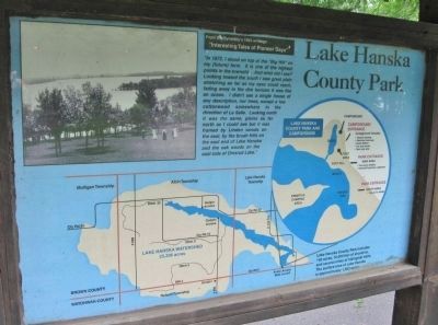
Lake Hanska County Park
From Ole Synsteby's 1933 writings:
"Interesting Tales of Pioneer Days"
"In 1872, I stood on top of the "Big Hill" on my (future) farm. It is one of the highest points in the township. And what did I see? Looking toward the south I saw great plain stretching as far as my eyes could reach, fading away in the dim horizon it was like an ocean. I didn't see a single house of any description, nor trees, except a low cottonwood somewhere in the direction of La Salle. Looking north it was the same, plains as far north as I could see but it was framed by Linden woods on the east, by the brush hills on the east end of Lake Hanska and the oak woods on the east side of Omsrud Lake."
Lake Hanska County Park includes 140 acres, 10,000 feet of shoreline, and several miles of hiking/ski trails. The surface area of Lake Hanska is approximately 1,800 acres.
Topics. This historical marker is listed in these topic lists: Horticulture & Forestry • Parks & Recreational Areas • Settlements & Settlers • Waterways & Vessels. A significant historical year for this entry is 1856.
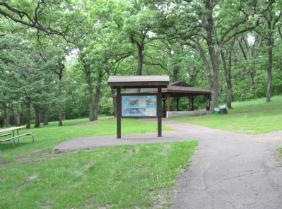
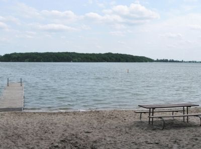
Location. 44° 7.376′ N, 94° 33.398′ W. Marker is near Hanska, Minnesota, in Brown County. Marker can be reached from County Road 11, 1.1 miles north of County Road 6, on the left when traveling north. Marker is near the swimming beach in Lake Hanska County Park. Touch for map. Marker is at or near this postal address: 10977 County Road 11, Hanska MN 56041, United States of America. Touch for directions.
Other nearby markers. At least 8 other markers are within 5 miles of this marker, measured as the crow flies. Omsrud Thordson – Torgrimson Log Cabin (about 400 feet away, measured in a direct line); Lake Hanska (about 500 feet away); Norwegian Stabbur (approx. 3½ miles away); World War Memorial (approx. 3½ miles away); Hanska (approx. 3.6 miles away); The Godahl Store (approx. 4.2 miles away); Site of Capture of the Younger Brothers (approx. 4.3 miles away); John Armstrong (approx. 4.6 miles away). Touch for a list and map of all markers in Hanska.
More about this marker. buff-colored marker insets:
Written by Ole for the column "Lakeshore News" in the Hanska Herald:
"Rumors are current that present Lake Hanska shall soon be a slough, as the importing of these monster (Hubbard) ditching machines make it possible to drain almost anything. For health's sake and present luxuries we enjoy we hope no human being tries to lower the lake level."
Ole worked hard to have a lake "with lots of water in it." In spite of a neighborhood dispute, compromise was achieved and a dam was built to maintain stable lake levels. As Ole wrote in 1933: "I do not know why but some used to call this the Synsteby Dam, for to ridicule me or to honor me, I do not know, and I did not care a snap. I got what I worked for and these same people who opposed me are giving me thanks today for what I did."
"A Few Remarks About Fort Hill Park" as written by Ole Synsteby.
"In spite of chilly northwest winds and now and then some straying snowflakes, spring has come, although late. Our hearts feel lighter and we think life is worth living this time of year, when we look around us and see everything that has life waking up."
Toward the end of his life, Ole could often be found on a hot summer day sitting at the barbed wire gate entrance to Fort Hill. He was guarding the gate so the cows didn't escape when it was carelessly left ajar by those using the lake. By his side was a tin cup, where
those who chose to could pay the admission of a dime for the area upkeep.
What Ole accomplished at Fort Hill Park in the early days of this century is phenomenal when one considers he had no truck or tractor. His hands, his horses and his children were his tools and building his entertainment complex and then keeping those buildings stocked and in order required countless hours of lugging and lifting.
Ole was an ecologist long before his time. He was a simple but complex man who had a deep respect for those who had been here before him.
photo captions:
1905 – The Hiawatha
This large gasoline launch accommodated up to 20 people. It was a great treat to ride in this boat and view the beautiful scenery on the shores of Lake Hanska. Ole also had 25 smaller boats that he rented for excursions on the lake.
The Beauty Spot of Lake Hanska – Fort Hill Amusement Park, 1920; Coffeehouse, concession stand and a pavilion for roller-skating and dances.
Regarding Lake Hanska Pioneer / Lake Hanska County Park. "The hills proved to be an ideal place for a fort, constructed of sod and logs, to help protect settlers in 1863, after the Uprising in 1862....
Ole Synsteby purchased land here in 1879. He planted many of the unusual trees still growing in the park. There were few trees in the days of the fort as soldiers 'can see twelve to fifteen miles in any direction.'” —excerpt from the park brochure
Also see . . .
1. Lake Hanska Park Overview. (Submitted on December 28, 2014.)
2. Fort Hill / Fort Hanska Site. (Submitted on December 28, 2014.)
Additional keywords. Fort Slocum; Fort Hanska
Credits. This page was last revised on October 1, 2023. It was originally submitted on December 28, 2014, by Keith L of Wisconsin Rapids, Wisconsin. This page has been viewed 736 times since then and 26 times this year. Photos: 1, 2, 3, 4, 5. submitted on December 28, 2014, by Keith L of Wisconsin Rapids, Wisconsin.
