Mud Street to Main Street
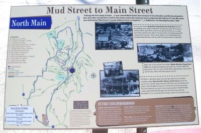
North Main
"It being the first street in town... it was named Main Street. But owing to its low elevation and the law of gravitation, the water would find a level in the street, and as the immense travel created an abundance of mud, the street was nicknamed 'Mud Street' a name without music or elegance." L.J. Kalklosch, The Healing Fountain, 1880
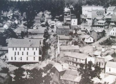
This long view shows North Main Street before the Great Fires when all the buildings were made of wood. Note the openness under the Grand Central Hotel which spanned the creek. In early days, this hotel was [used] as a stagecoach stop. Groceries were sold on the ground floor with lodging above. The wooden hotel burned in 1892 and was rebuilt in brick, billing itself as "the only brick fireproof hotel in the city with Onxy Spring water on each floor."
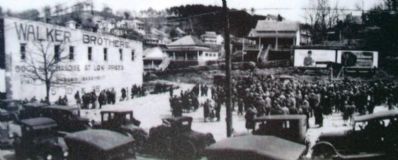
Right next to the Grand Central Hotel, Walker Brothers Department Store was a popular shopping place right up until the 1980s. The deep ravine next to it was covered with a large platform and used for special sales, rallies and other popular events.
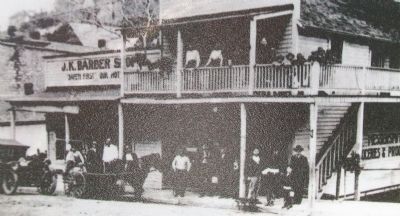
This block is still intact from the early days when it was a hub for everyday needs. Messersmith's Grocery and Produce was on the corner with a barber shop next door. The block was anchored on the other end by Bergdorf's Grocers in a fine brick and stone building.
This later became a center for the revival of pride in Ozark heritage led by sisters Edna Pike Bergdorf and Zoe Pike Harp and their husbands. It is currently the Main Stage Creative Community Center
In The Neighborhood
Leatherwood Creek Tunnels: Main Street's most prominent water feature is Leatherwood Creek, a tributary of the White River which now flows both openly and under Main Street in a long tunnel - one aspect of the mysterious Eureka Springs Underground. From Jackson Street to the east, you can get a good sense [of] the creek.
Jacob's Ladder:
Behind the Jackson Street overview of Leatherwood Creek is a long stairway leading up to many of the spring reservation parks on East Mountain.
Tibbs Alley: On the west side of Main Street is another stairway/street leading up to Center Street near Basin Spring Park.
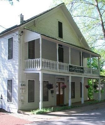
Hatchet Hall: The last home of fiery leader of the temperance movement, Carry A. Nation. This boarding house is located up the hill on Steel[e] Street reached by Jacob's Ladder (turn right at the top) or Flint Street. She operated the lodging here for several years before she collapsed after giving her final oration in Basin Spring Park in 1911. The deteriorating home was rescued by noted artists Elsa and Louis Freund in the 1930s, turned into a studio, school and gallery which formed the core of an arts community
which still thrives today in Eureka Springs.Landmarks [Map and Key]
This material is based upon work assisted by a grant from the U.S. Department of the Interior, National Park Service, a Preserve America grant. Any opinions, findings, and conclusions or recommendations expressed in this material are those of the author and do not necessarily reflect the views of the Department of the Interior. Photographs courtesy of the Cornerstone Bank of Eureka Springs, Eureka Springs Historical Museum and the Eureka Springs Carnegie Public Library.
Erected by Eureka Springs Downtown Network.
Topics. This historical marker is listed in these topic lists: Roads & Vehicles • Settlements & Settlers • Waterways & Vessels. A significant historical year for this entry is 1880.
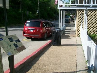
Location. 36° 24.159′ N, 93° 44.154′ W. Marker is in Eureka Springs, Arkansas, in Carroll County. Marker is at the intersection of Main Street (State Highway 23) and Flint Street, on the right when traveling north on Main Street. Touch for map. Marker is at or near this postal address: 61 North Main Street, Eureka Springs AR 72632, United States of America. Touch for directions.
Other nearby markers. At least 8 other markers are within walking distance of this marker. The Three Flat-Irons (about 300 feet away, measured in a direct line); Law Offices of F.O. Butt (about 300 feet away); Citizen's Bank Building
Also see . . .
1. Eureka Springs History. (Submitted on January 6, 2015, by William Fischer, Jr. of Scranton, Pennsylvania.)
2. Eureka Springs at Encyclopedia of Arkansas History & Culture. (Submitted on January 6, 2015, by William Fischer, Jr. of Scranton, Pennsylvania.)
Credits. This page was last revised on September 3, 2020. It was originally submitted on January 6, 2015, by William Fischer, Jr. of Scranton, Pennsylvania. This page has been viewed 535 times since then and 32 times this year. Photos: 1, 2, 3, 4, 5, 6. submitted on January 6, 2015, by William Fischer, Jr. of Scranton, Pennsylvania.
