Near Spencerville in Allen County, Ohio — The American Midwest (Great Lakes)
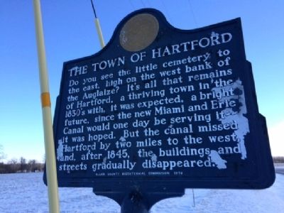
The Town of Hartford
Erected 1976 by Allen County Bicentennial Commission.
Topics. This historical marker is listed in these topic lists: Cemeteries & Burial Sites • Settlements & Settlers. A significant historical year for this entry is 1845.
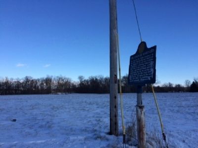
Location. Marker has been reported missing. It was located near 40° 44.142′ N, 84° 18.857′ W. Marker was near Spencerville, Ohio, in Allen County. Marker was on Defiance Trail, on the right when traveling north. The marker was located on Defiance Trail just south of the intersection with State Route 81. Touch for map. Marker was in this post office area: Spencerville OH 45887, United States of America. Touch for directions.
Other nearby markers. At least 8 other markers are within 3 miles of this location, measured as the crow flies. Hartford Cemetery Veterans Memorial (approx. 0.3 miles away); Cultural History of the Prairie (approx. 0.6 miles away); Where do Prairies come from? (approx. 0.6 miles away); Welcome to Kiracofe Prairie! (approx. 0.6 miles away); "Johnny Appleseed" (approx. 1.6 miles away); POW-MIA Still Missing / Wake Up America (approx. 2.2 miles away); Trail Designations (approx. 2.3 miles away); Recreation Along The Canal (approx. 2.3 miles away). Touch for a list and map of all markers in Spencerville.
Credits. This page was last revised on December 29, 2023. It was originally submitted on January 7, 2015, by Michael Baker of Lima, Ohio. This page has been viewed 775 times since then and 16 times this year. Last updated on November 26, 2023, by Craig Doda of Napoleon, Ohio. Photos: 1, 2, 3. submitted on January 7, 2015, by Michael Baker of Lima, Ohio. • Devry Becker Jones was the editor who published this page.


