Marker Logo HMdb.org THE HISTORICAL
MARKER DATABASE
“Bite-Size Bits of Local, National, and Global History”
Near New Martinsville in Wetzel County, West Virginia — The American South (Appalachia)
 

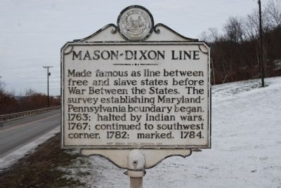
Mason-Dixon Line


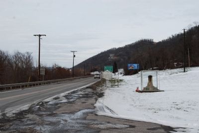
Mason-Dixon Line Marker image. Click for full size.
Photographed By Mike Wintermantel, January 11, 2015
1. Mason-Dixon Line Marker
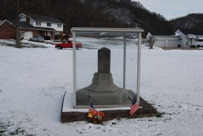
Inscription. Made famous as line between free and slave states before War Between the States. The survey establishing Maryland-Pennsylvania boundary began, 1763; halted by Indian wars, 1767; continued to southwest corner, 1782; marked, 1784.
 
Erected 1966 by West Virginia Historic Commission.
 
Topics and series. This historical marker is listed in these topic lists: Native AmericansPolitical SubdivisionsWar, US CivilWars, US Indian. In addition, it is included in the West Virginia Archives and History series list. A significant historical year for this entry is 1763.
 
Location. 39° 43.235′ N, 80° 49.382′ W. Marker is near New Martinsville, West Virginia, in Wetzel County. Marker is on West Virginia Route 2, 0.7 miles north of West Virginia Route 89. Located at the Marshall/Wetzel County line. Touch for map. Marker is in this post office area: New Martinsville WV 26155, United States of America. Touch for directions.
 
Other nearby markers. At least 8 other markers are within 6 miles of this marker, measured as the crow flies. Marshall County / Wetzel County (within shouting distance of this marker); Cedar Curve Cemetery / Funerals in the Early 1800s (approx. 3˝ miles away); Leonard Stout Hall (approx. 4.1 miles away); Zachary Taylor (approx. 5.7 miles away); Baker's Station (approx.
Paid Advertisement
Click on the ad for more information.
Please report objectionable advertising to the Editor.
Click or scan to see
this page online
5.7 miles away); Levi Morgan (approx. 6 miles away); New Martinsville (approx. 6 miles away); James G. West (approx. 6 miles away). Touch for a list and map of all markers in New Martinsville.
 
Mason-Dixon Line Marker image. Click for full size.
Photographed By Mike Wintermantel, January 11, 2015
2. Mason-Dixon Line Marker
Mason-Dixon Line Stone image. Click for full size.
Photographed By Mike Wintermantel, January 11, 2015
3. Mason-Dixon Line Stone
Located next to the Mason-Dixon Line marker
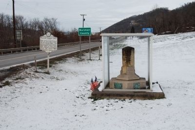
Mason-Dixon Line Stone image. Click for full size.
Photographed By Mike Wintermantel, January 11, 2015
4. Mason-Dixon Line Stone
Looking north towards Marshall County
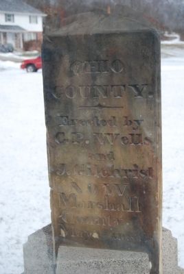
Mason-Dixon Line Stone image. Click for full size.
Photographed By Mike Wintermantel, January 11, 2015
5. Mason-Dixon Line Stone
Ohio County
Erected by C.P. Wells and J. Gilchrist
Now
Marshall County
May 1st-AD. 1835
Mason-Dixon Line Stone image. Click for full size.
Photographed By Mike Wintermantel, January 11, 2015
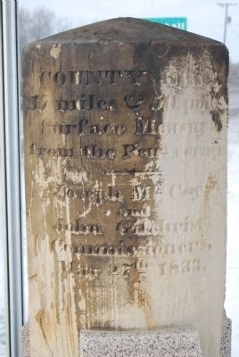
6. Mason-Dixon Line Stone
COUNTY LINE
17 miles & 50 poles
inscription is mostly unreadable
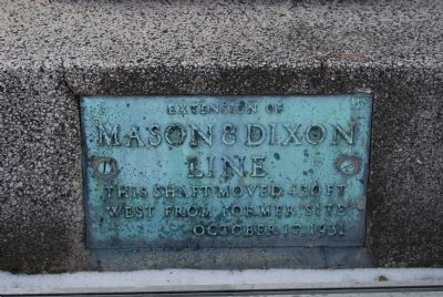
Mason-Dixon Line Stone plaque image. Click for full size.
Photographed By Mike Wintermantel, January 11, 2015
7. Mason-Dixon Line Stone plaque
Extension of
Mason & Dixon Line
This shaft moved 430 ft west from former site
October 17, 1931
 
 
Credits. This page was last revised on June 9, 2020. It was originally submitted on January 11, 2015, by Mike Wintermantel of Pittsburgh, Pennsylvania. This page has been viewed 2,478 times since then and 174 times this year. Photos:   1, 2, 3, 4, 5, 6, 7. submitted on January 11, 2015, by Mike Wintermantel of Pittsburgh, Pennsylvania.
Share this page.  
Share on Tumblr
m=80248

CeraNet Cloud Computing sponsors the Historical Marker Database.
This website earns income from purchases you make after using our links to Amazon.com. We appreciate your support.
Paid Advertisement
Apr. 24, 2024