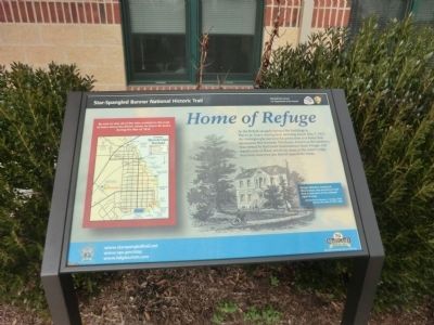
Home of Refuge
Star-Spangled Banner National Historic Trail
— War of 1812 —
(Inscription next to the image of the Pringle Mansion)
Pringle Mansion known as Bloomsbury, was located on land that is now part of the railroad right-of-way. Illustration by Benson J. Lossing, Field Book of the War of 1812, 1868
(Inscription next to the map)
Be sure to visit all of the sites marked on the map to learn about the British attack on Havre de Grace during the War of 1812.
Erected by National Park Service-United States Department of the Interior.
Topics and series. This historical marker is listed in this topic list: War of 1812. In addition, it is included in the Star Spangled Banner National Historic Trail series list. A significant historical date for this entry is May 3, 1813.
Location. 39° 32.688′ N, 76° 6.228′ W. Marker is in Havre de Grace, Maryland, in Harford County. Marker is on Lewis Lane. The marker is next to the building, Activity
Other nearby markers. At least 8 other markers are within walking distance of this marker. Count Rochambeau’s Troops (approx. 0.2 miles away); Havre de Grace Colored High School (approx. 0.6 miles away); Dedicated in Honor (approx. 0.6 miles away); No Respect (approx. 0.7 miles away); Havre de Grace Racetrack (approx. 0.7 miles away); War in the Chesapeake (approx. ¾ mile away); Surprise Attack (approx. ¾ mile away); "O! say can you see…" (approx. ¾ mile away). Touch for a list and map of all markers in Havre de Grace.
Credits. This page was last revised on September 2, 2022. It was originally submitted on January 17, 2015, by Don Morfe of Baltimore, Maryland. This page has been viewed 436 times since then and 27 times this year. Last updated on February 6, 2021, by Carl Gordon Moore Jr. of North East, Maryland. Photos: 1, 2. submitted on January 17, 2015, by Don Morfe of Baltimore, Maryland. • Bill Pfingsten was the editor who published this page.

