Baxter Springs in Cherokee County, Kansas — The American Midwest (Upper Plains)
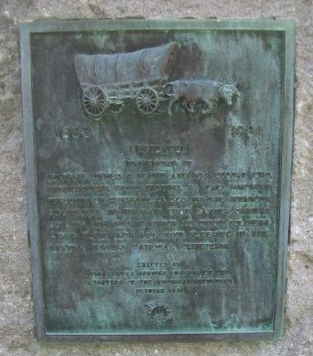
Baxter Springs Massacre
Dedicated in memory of General James G. Blunt and his escort who defenseless, fell victims to the inhuman ferocity of guerrillas, led by the infamous Quantrell in his raid upon Baxter Springs October 6th 1863, in which 135 Union soldiers were slain and are now sleeping in the Baxter Springs National Cemetery.
Erected 1931 by Baxter Springs Chapter, Daughters of the American Revolution.
Topics and series. This historical marker is listed in this topic list: War, US Civil. In addition, it is included in the Daughters of the American Revolution series list. A significant historical date for this entry is October 6, 1870.
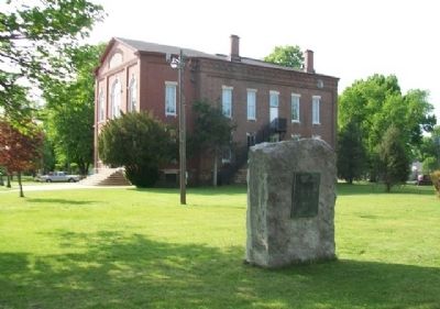
Location. 37° 1.566′ N, 94° 44.201′ W. Marker is in Baxter Springs, Kansas, in Cherokee County. Marker is at the intersection of Park Avenue and 10th Street, on the left when traveling north on Park Avenue. On the grounds of the Johnston Public Library. Touch for map. Marker is at or near this postal address: 210 West 10th Street, Baxter Springs KS 66713, United States of America. Touch for directions.
Other nearby markers. At least 8 other markers are within walking distance of this marker. Johnston Public Library (within shouting distance of this marker); Ohlen's Restaurant and Bakery (about 500 feet away, measured in a direct line); Polster Dry Goods Store (about 500 feet away); Drovers' and Farmers' Bank (about 500 feet away); Bischosberger Hotel (about 500 feet away); Wiggins House (about 500 feet away); Chicago Drug Store (about 500 feet away); Phillips 66 Petroleum Company Gas Station (about 600 feet away). Touch for a list and map of all markers in Baxter Springs.
Also see . . .
1. Battle of Baxter Springs. Wikipedia entry (Submitted on January 17, 2015, by William Fischer, Jr. of Scranton, Pennsylvania.)
2. Fort Blair & the Baxter Springs Massacre. Legends of America website entry (Submitted on January 17, 2015, by William Fischer, Jr. of Scranton, Pennsylvania.)
3. Baxter Springs City Cemetery Soldiers' Lot. VA National Cemetery Administration website entry (Submitted on January 17, 2015, by William Fischer, Jr. of Scranton, Pennsylvania.)
4. Blunt's Flag Captured by Quantrill's Raiders. Kansas Historical Society website entry (Submitted on January 17, 2015, by William Fischer, Jr. of Scranton, Pennsylvania.)
5. Baxter Springs Heritage Center and Museum. Museum website homepage (Submitted on January 17, 2015, by William Fischer, Jr. of Scranton, Pennsylvania.)
Credits. This page was last revised on March 16, 2024. It was originally submitted on January 17, 2015, by William Fischer, Jr. of Scranton, Pennsylvania. This page has been viewed 661 times since then and 19 times this year. Photos: 1, 2, 3. submitted on January 17, 2015, by William Fischer, Jr. of Scranton, Pennsylvania.


