French Quarter in New Orleans in Orleans Parish, Louisiana — The American South (West South Central)
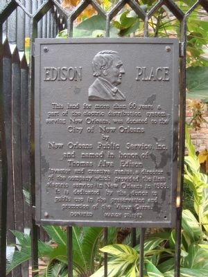
Edison Place
It is dedicated by the donor to public use in the preservation and promotion of the Vieux Carre. Donated March 30, 1973.
Erected 1973 by New Orleans Public Service, Inc.
Topics. This historical marker is listed in these topic lists: Industry & Commerce • Notable Places. A significant historical date for this entry is March 30, 2012.
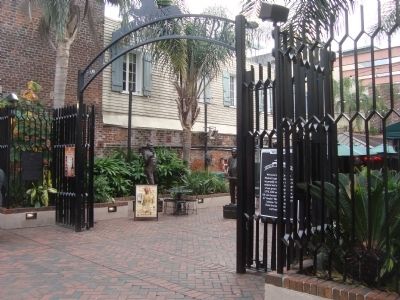
Location. 29° 57.351′ N, 90° 4.109′ W. Marker is in New Orleans, Louisiana, in Orleans Parish. It is in the French Quarter. Marker is on Bourbon Street north of Bienville Street, on the left when traveling north. Touch for map. Marker is at or near this postal address: 313 Bourbon Street, New Orleans LA 70130, United States of America. Touch for directions.
Other nearby markers. At least 8 other markers are within walking distance of this marker. Site of Kolly Townhouse (a few steps from this marker); Original Old Absinthe Bar (within shouting distance of this marker); These Three Townhouses (about 300 feet away, measured in a direct line); Audubon Room (about 400 feet away); Rillieux – Waldhorn House (about 400 feet away); Jack Teagarden (about 500 feet away); Conway’s Court (about 500 feet away); Hermann – Grima House (about 500 feet away). Touch for a list and map of all markers in New Orleans.
Credits. This page was last revised on February 12, 2023. It was originally submitted on January 7, 2012, by Barry Swackhamer of Brentwood, California. This page has been viewed 1,468 times since then and 87 times this year. Last updated on January 20, 2015, by Richard E. Miller of Oxon Hill, Maryland. Photos: 1, 2, 3. submitted on January 7, 2012, by Barry Swackhamer of Brentwood, California. • Bernard Fisher was the editor who published this page.


