Zion National Park in Washington County, Utah — The American Mountains (Southwest)
Westward Expansion
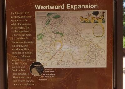
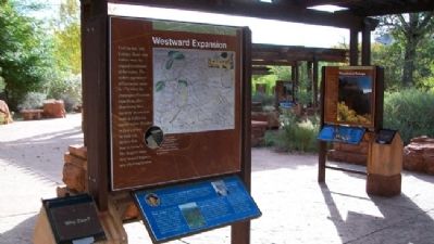
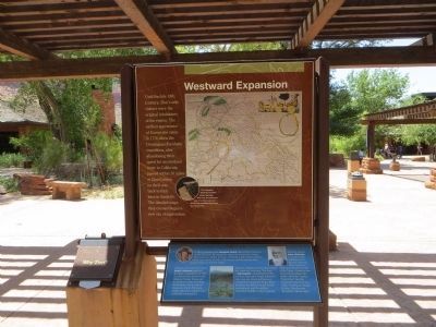
Until the late 18th Century, Zion's only visitors were the original inhabitants of the region. The earliest appearance of Europeans came in 1776 when the Dominguez-Escalante expedition after abandoning their quest for an overland route to California passed within 20 miles of Zion Canyon on their way back to their base in Santa Fe. The detailed maps they created began a new era of exploration.
(Top marker photo caption) The Dominguez-Escalante expedition crossed the Virgin River near the present day town of La Verkin, just west of Zion, and proceeded east toward the Colorado River.
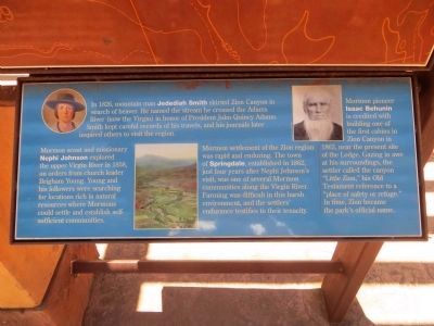
(Lower marker captions, clockwise from top) In 1826, mountain man Jedediah Smith skirted Zion Canyon in search of beaver. He named the stream he crossed the Adams River (now the Virgin) in honor of President John Quincy Adams. Smith kept careful records of his travels, and his journals later inspired others to visit the region.
Mormon pioneer Isaac Behunin is credited with building one of the first cabins in Zion Canyon in 1863, near the present site of the Lodge. Gazing in awe at his surroundings, the settler called the canyon “Little Zion,” his Old Testament reference to a “place of safety or refuge.” In time, Zion became the park’s official name.
Mormon settlement of the Zion region was rapid and enduring. The town of Springdale, established in 1862, just four years after Nephi Johnson’s visit, was one of several Mormon communities along the Virgin River. Farming was difficult in this hard environment, and the settlers’ endurance testifies to their tenacity.
Mormon scout and missionary Nephi Johnson explored the upper Virgin River in 1858, on orders from church leader Brigham Young. Young and his followers were searching for locations rich in natural resources where Mormons could settle and establish self sufficient communities.
Erected by National Park Service.
Topics and series. This historical marker is listed in these topic lists: Exploration • Hispanic Americans • Native Americans. In addition, it is included in the Dominguez y Escalante Expedition, and the Former U.S. Presidents: #06 John Quincy Adams series lists. A significant historical year for this entry is 1776.
Location. 37° 12.011′ N, 112° 59.253′ W. Marker is in Zion National Park, Utah, in Washington County. Marker is under the northernmost open-sided pavilion on the plaza west adjacent to the Zion National Park Visitor Center (near the south park entrance). Touch for map. Marker is in this post office area: Springdale UT 84767, United States of America. Touch for directions.
Other nearby markers. At least 8 other markers are within 6 miles of this marker, measured as the crow flies. Promised Land (here, next to this marker); Birth of a Park (here, next to this marker); Original Inhabitants / Living Traditions (within shouting distance of this marker); Stephen Tyng Mather (approx. ¾ mile away); Discovery of Zion Canyon (approx. one mile away); Zion Mt. Carmel Tunnel and Highway, Utah (approx. 1½ miles away); Rockville Bridge (approx. 4 miles away); Cables from the Rim (approx. 5.6 miles away). Touch for a list and map of all markers in Zion National Park.
Also see . . .
1. Zion National Park. (Submitted on February 21, 2011, by William Fischer, Jr. of Scranton, Pennsylvania.)
2. Dominguez-Escalante Route Map. (Submitted on February 21, 2011, by William Fischer, Jr. of Scranton, Pennsylvania.)
Credits. This page was last revised on October 14, 2020. It was originally submitted on February 21, 2011, by William Fischer, Jr. of Scranton, Pennsylvania. This page has been viewed 772 times since then and 15 times this year. Last updated on January 30, 2015, by J. Makali Bruton of Accra, Ghana. Photos: 1. submitted on June 20, 2014, by Bill Kirchner of Tucson, Arizona. 2. submitted on February 21, 2011, by William Fischer, Jr. of Scranton, Pennsylvania. 3, 4. submitted on June 20, 2014, by Bill Kirchner of Tucson, Arizona. • Bill Pfingsten was the editor who published this page.


