Near Manhattan in Riley County, Kansas — The American Midwest (Upper Plains)
The Tallgrass Prairie
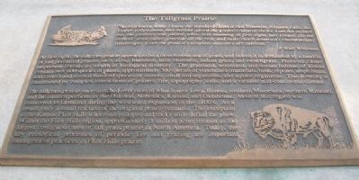
"As to scenery, while I know the standard claim is that Yosemite, Niagara Falls, the Upper Yellowstone, and the like afford the greatest natural shows, I am not so sure but the prairies and plains, while less stunning at first sight, last longer, fill the esthetic sense fuller, precede all the rest, and make North America's characteristic landscape. Even the prairie's simplest statistics are sublime."
- Walt Whitman
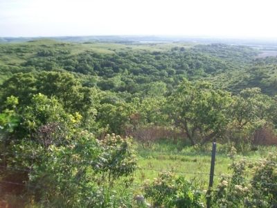
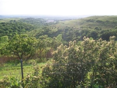
At first sight, the tallgrass prairie appears to be a monotonous sea of grass, and indeed it is dominated by a handful of tall perennial grasses such as big bluestem, little bluestem, Indian grass, and switchgrass. However, closer inspection reveals its wealth of biological diversity. The grassland, woodland, and stream habitats of Konza contain over 600 species of plants, approximately 300 species of vertebrates (mammals, birds, reptiles, amphibians, and fishes) and several hundred species of insects, small soil organisms, and aquatic organisms. This diversity is maintained by complex interactions of grazers, fire, topography, soils, and a variable mid-continental climate.
The tallgrass prairie once stretched over most of what is now Iowa, Illinois, southern Minnesota, northern Missouri, and the eastern portions of the Dakotas, Nebraska, Kansas, and Oklahoma. Most of this region was converted to farmland during the westward expansion in the 1800's. As a result, only a small fraction of the original prairie remains. The exception is the Kansas Flint Hills where steep slopes and rocky soils defied the plow. Within the Flint Hills region, approximately 5 million acres remain as the largest contiguous area of tall grass prairie in North America. Today, the key ecological processes of periodic fire and grazing are important management practices in Flint Hills prairie.
Erected 1997 by The Nature Conservancy and the Kansas State University Division of Biology.
Topics. This historical marker is listed in this topic list: Environment.
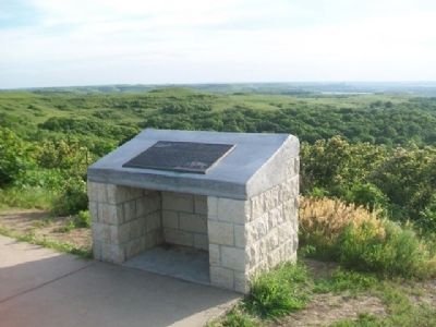
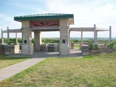
Location. 39° 7.933′ N, 96° 32.41′ W. Marker is near Manhattan, Kansas, in Riley County. Marker is on Pillsbury Drive, 5 miles north of Interstate 70, on the left when traveling north. Marker is at the Konza Prairie-Kansas River Valley Interpretive Center. Touch for map. Marker is at or near this postal address: 3700 Pillsbury Drive, Manhattan KS 66502, United States of America. Touch for directions.
Other nearby markers. At least 8 other markers are within 4 miles of this marker, measured as the crow flies. Konza Prairie (about 300 feet away, measured in a direct line); Geology at Konza (about 300 feet away); Manhattan's Union Pacific Depot - Revived (approx. 3.2 miles away); Yuma Street (approx. 3.2 miles away); Change & Growth (approx. 3.2 miles away); Colorado Street (approx. 3.3 miles away); The American Veteran (approx. 3˝ miles away); Riley County Courthouse (approx. 3˝ miles away). Touch for a list and map of all markers in Manhattan.
Also see . . .
1. K-177 Overlook Park. Riley County website entry (Submitted on February 13, 2015, by William Fischer, Jr. of Scranton, Pennsylvania.)
2. Konza Prairie. University of Kansas website entry (Submitted on February 13, 2015, by William Fischer, Jr. of Scranton, Pennsylvania.)
3. Flint Hills. GeoKansas website entry (Submitted on February 1, 2022, by Larry Gertner of New York, New York.)
4. Tallgrass Prairie National Preserve. NPS website entry (Submitted on February 13, 2015, by William Fischer, Jr. of Scranton, Pennsylvania.)
Credits. This page was last revised on February 1, 2022. It was originally submitted on February 13, 2015, by William Fischer, Jr. of Scranton, Pennsylvania. This page has been viewed 466 times since then and 23 times this year. Photos: 1, 2, 3, 4, 5, 6. submitted on February 13, 2015, by William Fischer, Jr. of Scranton, Pennsylvania.
