Vieux-Québec-Cap-Blanc-colline Parlementaire in Communauté-Urbaine-de-Québec, — Central Canada (French-Canadian)
Martello Towers in Quebec / Tours Martello de Québec
Martello Tower 1 / Tour Martello 1

Photographed By Barry Swackhamer, July 25, 2014
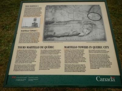
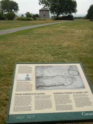
1. Martello Towers in Quebec / Tours Martello de Québec Marker
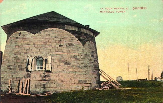
Captions (English / French): (left) Martello Tower 1, 1909. / Tour Martello 1, 1909.; (right) Plan of the city and fortifications of Quebec. / Plan de la ville et des fortifications de Québec.
In the early 19th century, the British were afraid that the Americans, having won their independence in 1776, would try to annex Upper and Lower Canada. In the face of this threat, Gother Mann, Canada’s chief engineer (1785-1804), recommended a new defensive system for Quebec City that involved, among other things, occupying the Heights of Abraham. In view of the urgency of the situation, the colony’s governor, James Craig, authorized part of the work without waiting for advice from London.
Ralph Bruyéres, Mann’s successor, began the construction of four Martello towers in the summer of 1808. Distinctive in shape, these coastal defense structures were widely used in Great Britain and in the British colonies. In expensive to erect and easy to defend, the Martello towers were arranged to provide for each others defence in a nearly parallel line to the city walls across the whole width of the promontory.
Their structure is distinctive: the west wall, which faces the enemy, is very thick, while the east wall is thinner and can be easily destroyed from the city walls in the event the tower is taken. By the time war broke out in 1812, the Martello towers were completed and ready for use. However, they never attacked. After the military period, the Martello towers were used for various purposes and extensively repaired to preserve them, except for Tower 3, which was demolished in 1905.
Overlooking the St. Lawrence River, Martello Tower 1 occupies an important position. Nearly identical to Martello Tower 4, it could accommodate a garrison of approximately 12 men. In the early 20th century, it was used to support a cistern for the Ross Rifle Factory. Later, the Royal Astronomical Society of Canada used the tower as an observatory; thousands of amateur astronomers came to gaze at the stars from 1941 until the 1960s. Today, historical interpretation and other activities are held in the tower.
French:
Au début du XIXᵉ siècle, les Britanniques craignent que les Américains, suite à l’obtention de leur indépendance (1776), ne tentent d’annexer le Haut et les Bas Canada à leur territoire. Devant cette menace, Gother Mann, ingénieur en chef du Canada (1785-1894), préconise un nouveau système défensif pour Québec et vise, entre autres, l’occupation des Hauteurs d’Abraham. Devant l’urgence de la situation, le gouverneur de la colonie, James Craig, autorise une partie de ces travaux sans attendre l’avis de Londres.
Ralph Bruyères, successeur de Mann, entreprend donc la construction de quatre tours Martello à l’étè de 1808. De forme distincte, ces ouvrages défensifs côtiers sont alors largement répandus
en Angleterre et dans les colonies britanniques. Peu coûteuses à construire et faciles à défendre, les tours Martello sont dispersées à peu près parallèlement à l’enceinte sur toute la largeur du promontoire et se protègent mutuellement.
Leur structure es particulière: le mur ouest, qui fait face à l’ennemi, est très épais alors que le mur est, plus mince, peut facilement être détruit de l’enceinte au cas oû la tour serait prise. En 1812, lorsque la guerre éclate. les tours Martello sont terminées et prêtes à servir. Elles ne sont toutefois jamais attaquées. Après la période militaire, les tours Martello connaissent différents usages et sont préservées grâce à d’importants travaux de réfection, à l’exception de la tour 3 qui est démolie en 1905.
Surplombant le fleuve St-Laurent, la tour Martello 1 occupe une position importante. Quasi identique à la tour Martello 4, elle peut abriter une garnison d’environ 12 hommes. Au début de XXᵉ siècle, elle est utilisée pour soutenir une citerne de la fabrique d’armes, la Ross Rifle Factory. Plus tard, la Société royale d’astronomie du Canada utilise la tour comme observatoire; des milliers d’amateurs y admirent les astres de 1941 jusque dans les années 1960. De nos jours, des activités d’animation et d’interprétation historique s’y déroulent.
Erected by Parks Canada Parcs.
Topics. This historical marker is listed in this topic list: Forts and Castles. A significant historical year for this entry is 1776.
Location. 46° 48.189′ N, 71° 13.102′ W. Marker is in Québec, in Communauté-Urbaine-de-Québec. It is in Vieux-Québec-Cap-Blanc-colline Parlementaire. Marker can be reached from Avenue George VI close to Avenue Taché, on the right when traveling east. Touch for map. Marker is in this post office area: Québec G1R, Canada. Touch for directions.
Other nearby markers. At least 8 other markers are within walking distance of this marker. Montcalm (within shouting distance of this marker); Martello Towers / Tours Martello (about 90 meters away, measured in a direct line); O Canada! (about 90 meters away); Do You Know Joan of Arc? (about 120 meters away); A Golf Club on the Plains of Abraham (about 120 meters away); Frederick G. Todd (about 120 meters away); Québec Martello Towers (about 150 meters away); Le Siège de Québec, 1759 / The Siege of Québec, 1759 (approx. 0.2 kilometers away). Touch for a list and map of all markers in Québec.
More about this marker. This marker is in National Battlefields Park on the path to Martello Tower 1.
Credits. This page was last revised on February 9, 2023. It was originally submitted on February 17, 2015, by Barry Swackhamer of Brentwood, California. This page has been viewed 394 times since then and 22 times this year. Photos: 1, 2. submitted on February 17, 2015, by Barry Swackhamer of Brentwood, California. 3. submitted on February 22, 2015. • Andrew Ruppenstein was the editor who published this page.

