Vieux-Québec - Montcalm in Communauté-Urbaine-de-Québec, — Central Canada (French-Canadian)
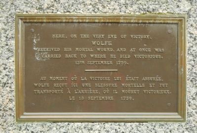
Here, on the very eve of victory
Au moment où la victoire lui était assurée
Wolfe
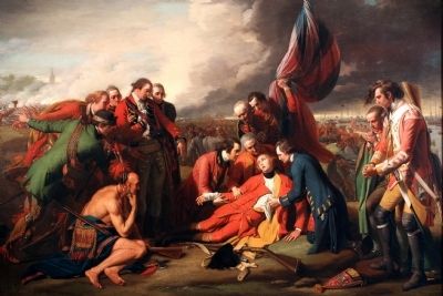
received his mortal wound, and at once was
carried back to where he died victorious.
13th September 1759.
French:
Wolfe reçut ici un blessure mortelle et fut transporté à l’arrière, où il mourut victorieux. Le 13 septembre 1759.
Erected by National Battlefields Commission / Commission des champs de bataille nationaux.
Topics. This historical marker is listed in this topic list: War, French and Indian. A significant historical date for this entry is September 13, 1759.
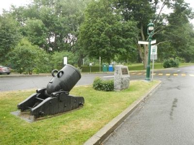
Location. 46° 48.063′ N, 71° 13.279′ W. Marker is in Québec, in Communauté-Urbaine-de-Québec. It is in Vieux-Québec - Montcalm. Marker is on Avenue George VI close to Rue Garneau, on the left when traveling east. Touch for map. Marker is in this post office area: Québec G1R 2L3, Canada. Touch for directions.
Other nearby markers. At least 8 other markers are within walking distance of this marker. Bragg’s 28th Foot, (within shouting distance of this marker); Quebec City Astronomical Observatory (within shouting distance of this marker); The “Louisbourg Grenadiers” (within shouting distance of this marker); The / Le Royal Roussillon, (within shouting distance of this marker); Frederick G. Todd (about 180 meters away, measured in a direct line); Cornelius Krieghoff (about 210 meters away); Pavillon Charles-Baillairgé (approx. 0.2 kilometers away); La Maison Henry-Stuart / Henry-Stuart House (approx. 0.3 kilometers away). Touch for a list and map of all markers in Québec.
Also see . . .
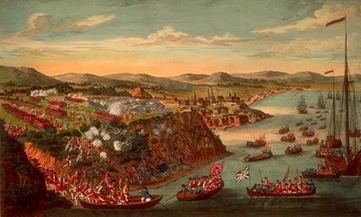
1. Battle of the Plains of Abraham - Canadian Encyclopedia. The Battle of the Plains of Abraham (13 September 1759) was a pivotal moment in the Seven Years’ War and in the history of Canada. A British invasion force led by General James Wolfe defeated French troops under the Marquis de Montcalm, leading to the surrender of Québec to the British. Both commanding officers died from wounds sustained during the battle. (Submitted on February 19, 2015, by Barry Swackhamer of Brentwood, California.)
2. Battle of Quebec, 1759 - British Battles. Wolfe formed his army on the plains in a single line of battalions, the right resting on the edge of the heights above the St Lawrence... Montcalm did not become aware of the British incursion until the morning, when he saw the line formed outside Quebec. (Submitted on February 19, 2015, by Barry Swackhamer of Brentwood, California.)
3. Battle of the Plains of Abraham - Canadian Encyclopedia. While the French forces continued to fight and prevailed in several battles after Quebec was captured, the British did not relinquish their hold on the virtually impregnable Citadelle. That tenacity carried over to other areas in North America; within four years, with the Treaty of Paris, France ceded most of its possessions in eastern North America to Great Britain. (Submitted on February 19, 2015, by Barry Swackhamer of Brentwood, California.)
Credits. This page was last revised on February 9, 2023. It was originally submitted on February 19, 2015, by Barry Swackhamer of Brentwood, California. This page has been viewed 374 times since then and 13 times this year. Photos: 1, 2, 3, 4. submitted on February 19, 2015, by Barry Swackhamer of Brentwood, California. • Andrew Ruppenstein was the editor who published this page.


