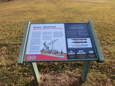
Naval Warfare
Barges, Boats, & Frigates
— The Opposing Forces —
The American guns ranged in size from 12-pounders to 41-pounders with 18-and 24-pounders the most numerous. Barney was opposed by a British fleet that outgunned him by more than four-to-one, even without including the 74-gun ship-of-the patrolling at the mouth of the Patuxent River.
The British ships stationed off the mouth of St. Leonard Creek were the 38-gun frigate HMS Loire, the 18-gun frigate MHS St. Lawrence, and the 18-gun sloop HMS Jaseur.
Fortunately, these vessels were too large to sail very far into the creek.
To engage the United States Chesapeake Flotilla within the creek, the British relied on 21 barges and two small schooners, each carrying a single cannon.
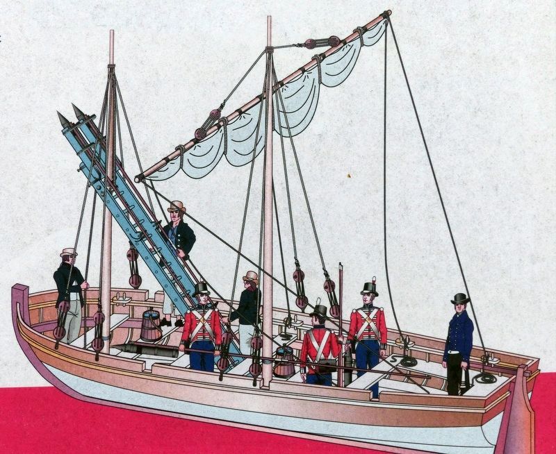
In addition, the British had a small boat armed with their newest weapon---the terrifying Congreve rocket.
Following the First Battle of St. Leonard Creek, the British were reinforced by the 32-gun frigate HMS Narcissus and several smaller boats. Despite the overwhelming strength of the forces aligned against him, Commodore Joshua Barney with the assistance of hastily erected
shore batteries, was able to escape up the Patuxent in late June o 1814.
(Inscription beside the image in the lower center)
British Rocket Boat, Illustration by Carl E. Franklin.
Rockets Red Glare
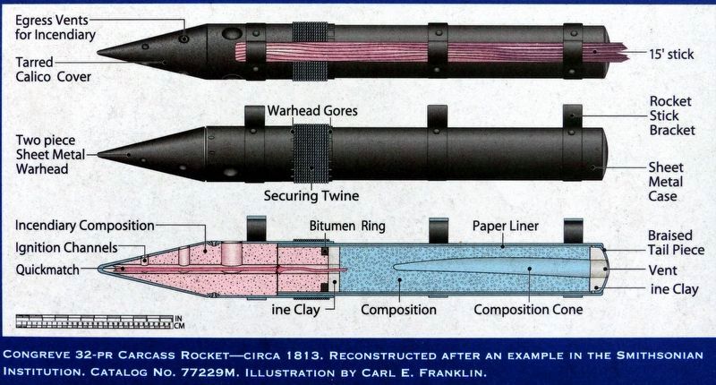
Ballistic Warfare-Congreve Rockets-Developed by William Congreve in 1804, these self-propelled projectiles carried an incendiary or explosive charge for a distance of up to two miles. A sheet iron tube containing the propellant charge was attached to a long wooden shaft which served as a stabilizer during flight.
The “rockets red glare” in the song “The Star-Spangled Banner” refers to these rockets, which were used both at the Battle of Baltimore and here at the Battles of St. Leonard Creek.
Because of the rockets’ unpredictable flight, they terrorized both the military and civilians, but did relatively little damage to their intended targets.
(Inscription below the drawings on the right)
Congreve 32-pr Carcase Rocket—circa 1813. Reconstructed after an example in the Smithsonian Institution, Catalog No. 77229M. Illustration by Carl E. Franklin.
Funding provided to the Friends of Jefferson Patterson Park and Museum, Inc. by the Chesapeake Bay Gateways Network, National Park Service.
Erected by Maryland Department of Housing and Community Development.
Topics. This historical
Location. 38° 23.896′ N, 76° 30.434′ W. Marker is in St. Leonard, Maryland, in Calvert County. Marker is on Jefferson Patterson Park Road. The marker is located on the grounds of the Jefferson Patterson Park and Museum near the Visitor Center. Touch for map. Marker is in this post office area: Saint Leonard MD 20685, United States of America. Touch for directions.
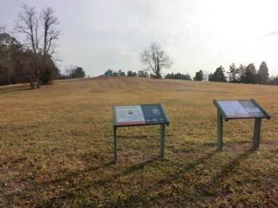
Other nearby markers. At least 8 other markers are within walking distance of this marker. The War of 1812 Living History (here, next to this marker); Weapons of War (within shouting distance of this marker); Jefferson Patterson Park & Museum (within shouting distance of this marker); Fate of the Flotilla (about 400 feet away, measured in a direct line); a different marker also named Jefferson Patterson Park & Museum (about 500 feet away); What is this Big White Building? (approx. ¼ mile away); The Government at St. Leonard’s (approx. ¼ mile away); Attention to Detail-Gertrude Sawyer, Architect (approx. ¼ mile away). Touch for a list and map of all markers in St. Leonard.
Credits. This page was last revised on July 22, 2016. It was originally submitted on February 20, 2015, by Don Morfe of Baltimore, Maryland. This page has been viewed 566 times since then and 12 times this year. Photos: 1, 2, 3. submitted on February 20, 2015, by Don Morfe of Baltimore, Maryland. 4, 5. submitted on July 13, 2016, by Allen C. Browne of Silver Spring, Maryland. • Bill Pfingsten was the editor who published this page.
