Marker Logo HMdb.org THE HISTORICAL
MARKER DATABASE
“Bite-Size Bits of Local, National, and Global History”
Near Thibodaux in Lafourche Parish, Louisiana — The American South (West South Central)
 

Laurel Valley


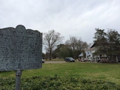
Laurel Valley Marker image. Click for full size.
Photographed By Mark Hilton, February 20, 2015
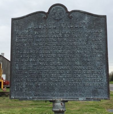
1. Laurel Valley Marker
Inscription. A 1785 Spanish Land Grant to Acadian Etienne Boudreaux is part of the largest surviving 19th Century Plantation manufacturing complex in the United States. Over 70 structures, including a sugar house, school, general store and workers' cottages are still standing. Raided by Union soldiers, the Civil War ended its role as the parish's leading sugar producer. Revitalized at the turn of the century, the operation utilized 250 mules, a saw mill, a 15 mile railway system and was home to over sixty resident families.
 
Erected by the Lafourche Heritage Society, Inc.
 
Topics. This historical marker is listed in these topic lists: Colonial EraRailroads & StreetcarsSettlements & SettlersWar, US Civil. A significant historical year for this entry is 1785.
 
Location. 29° 47.374′ N, 90° 47.211′ W. Marker is near Thibodaux, Louisiana, in Lafourche Parish. Marker is on State Highway 308, 0.1 miles south of Percy Brown Road (State Highway 648), on the left when traveling south. Located in front of the Laurel Valley Village Store. Touch for map. Marker is at or near this postal address: 595 LA-308, Thibodaux LA 70301, United States of America. Touch for directions.
 
Other nearby markers. At least 8 other markers are within 2 miles of this marker, measured as the crow flies. Acadia Plantation (approx. ¾ mile away); City of Thibodaux / Ville de Thibodaux (approx.
Paid Advertisement
Click on the ad for more information.
Please report objectionable advertising to the Editor.
Click or scan to see
this page online
one mile away); The St. Joseph Cemetery Calvary-Grotto Shrine (approx. 1.4 miles away); Our Confederate Dead (approx. 1½ miles away); St. Joseph Cemetery (approx. 1½ miles away); Thibodaux College (approx. 1.6 miles away); Rienzi Plantation House (approx. 1.7 miles away); Moses, Allen Chapel, Calvary Cemeteries (approx. 1.8 miles away). Touch for a list and map of all markers in Thibodaux.
 
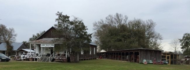
Laurel Valley Store image. Click for full size.
Photographed By Mark Hilton, February 20, 2015
2. Laurel Valley Store
Laurel Valley Store outbuildings image. Click for full size.
Photographed By Mark Hilton, February 20, 2015
3. Laurel Valley Store outbuildings
Long building includes many old tractors.
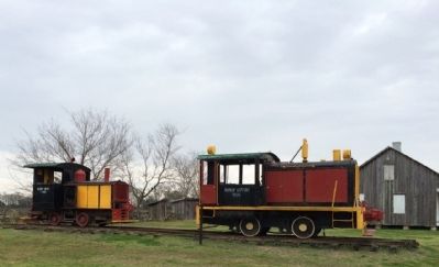
Train engines from 1785 & 1906 image. Click for full size.
Photographed By Mark Hilton, February 20, 2015
4. Train engines from 1785 & 1906
 
 
Credits. This page was last revised on October 27, 2020. It was originally submitted on February 25, 2015, by Mark Hilton of Montgomery, Alabama. This page has been viewed 636 times since then and 24 times this year. Photos:   1, 2, 3, 4. submitted on February 25, 2015, by Mark Hilton of Montgomery, Alabama.
Share this page.  
Share on Tumblr
m=81067

CeraNet Cloud Computing sponsors the Historical Marker Database.
This website earns income from purchases you make after using our links to Amazon.com. We appreciate your support.
Paid Advertisement
Apr. 25, 2024