Carlin in Eureka County, Nevada — The American Mountains (Southwest)
Hot, Dusty and Tattered
Beowawe

Photographed By Barry Swackhamer, August 29, 2014
1. Hot, Dusty and Tattered Marker
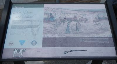
Caption: (top, right) “Some of us are shoeless, hatless and nearly clothes less and we are generally so tired that when we arrive at camp that we feel no inclination to mend or repair the rents in our clothes sustain on our journey.” — Joseph Waring Berrin, 1849.
(bottom row) Milk Cow - Livestock were taken on the journey to provide a supply of fresh milk and in extreme circumstances slaughtered as an additional source of meat.; Percussion Cap Rifle - The successor to the earlier flintlock rifle, it trigger released a hammer which hit a cap with a fulminate charge of mercury which in turn ignited the rifle’s powder charge.
(bottom row) Milk Cow - Livestock were taken on the journey to provide a supply of fresh milk and in extreme circumstances slaughtered as an additional source of meat.; Percussion Cap Rifle - The successor to the earlier flintlock rifle, it trigger released a hammer which hit a cap with a fulminate charge of mercury which in turn ignited the rifle’s powder charge.
In this mental picture, emigrants and animals are completely covered from head to foot in gray dust. Cloths are tatters, and the weary travelers busy themselves discarding items from their wagons in an effort to lighten the loads that their exhausted oxen, mules, and horses must pull.
Other emigrants may be dismantling their wagons and using the parts to construct pack saddles. Armed guards are posted near grazing livestock to protect them from being stolen or killed by Native Americans. For the Native Americans, those livestock could help replace food sources that disappeared as a result of the tens of thousands of emigrants traveling through their homeland.
Erected by Department of the Interior, Bureau of Land Management & State of Nevada.
Topics. This historical marker is listed in these topic lists: Exploration • Roads & Vehicles.
Location. 40° 40.794′ N, 116° 28.413′ W. Marker is in Carlin, Nevada, in Eureka County. Marker is on Interstate 80. Touch for map. Marker is in this post office area: Carlin NV 89822, United States of America. Touch for directions.
Other nearby markers. At least 7 other markers are within 6 miles of this marker, measured as the crow flies. The Cattle Industry (within shouting distance of this marker); Argenta Station (within shouting distance of this marker); Gravely Ford (approx. 0.3 miles away); A Tale of Two Highways (approx. 0.3 miles away); About Your Journey ... (approx. 0.3 miles away); Beowawe Geysers (approx. 0.3 miles away); California Trail - 1841 Route (approx. 5.1 miles away).
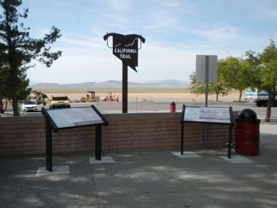
More about this marker. This marker is located at the north-side Beowawe Rest Area on west bound Interstate 80.

Photographed By Barry Swackhamer, August 29, 2014
3. About Your Journey
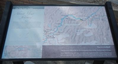
Whichever direction your travels take you, you’re going to have a similar experience to what the California-bound emigrants had. You’re going to see the same country, except for the towns and the ranch meadows. The big difference though, is that you’ll be traveling at a much faster pace. From here, you can be in California in a few hours. For the emigrants, it was as much as a month’s journey. As you drive and look at the country, think about those people who plodded along day after day through the thick alkali dust and sand — headed toward dreams of gold or a new life.
Captions: (bottom left) The California Trail had its beginnings at several points along the Missouri River, and included several variant routes across the Great Basin and over the Sierra Nevada mountains. With the completion of the transcontinental railroad in 1869, most travelers made the journey by rail.; (bottom right) You’re Invited! There are many California Trail sites like this one, spread across Nevada. They’re marked on this map. As you stop at these sites, you’ll learn about what happened to these emigrants as they traveled across the Great Basin. Be sure to visit the California Trail Interpretive Center just west of Elko, Nevada.
This plaque is found at each of the BLM California Trail Interpretative Sites.
Credits. This page was last revised on June 16, 2016. It was originally submitted on March 3, 2015, by Barry Swackhamer of Brentwood, California. This page has been viewed 413 times since then and 15 times this year. Photos: 1, 2, 3. submitted on March 3, 2015, by Barry Swackhamer of Brentwood, California. • Syd Whittle was the editor who published this page.
