San Diego in San Diego County, California — The American West (Pacific Coastal)
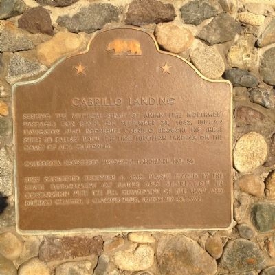
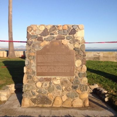
Cabrillo Landing
California Registered Historical Landmark No. 56
First registered December 6, 1932. Plaque placed by the State Department of Parks and Recreation in cooperation with the U.S. Department of the Navy and Squibob Chapter, E Clampus Vitus, September 26, 1992.
Erected 1992 by Squibob Chapter, E Clampus Vitus. (Marker Number 56.)
Topics and series. This historical marker is listed in this topic list: Exploration. In addition, it is included in the California Historical Landmarks, and the E Clampus Vitus series lists. A significant historical month for this entry is September 1879.
Location. 32° 41.024′ N, 117° 14.202′ W. Marker is in San Diego, California, in San Diego County. Marker is at the intersection of Rosecrans Street and Guijarros Road on Rosecrans Street. This Marker is located inside Naval Base Point Loma. Touch for map. Marker is in this post office area: San Diego CA 92106, United States of America. Touch for directions.
Other nearby markers. At least 8 other markers are within walking distance of this marker. Ballast Point Whaling Station Site (a few steps from this marker); Fort Guijarros Site (a few steps from this marker); Buque Escuela Juan Sebastian de Elcano (a few steps from this marker); Fort Rosecrans (within shouting distance of this marker); Moreton Bay Fig (about 800 feet away, measured in a direct line); Post Chapel, Building 213 (approx. 0.3 miles away); First Holy Mass Celebrated in California (approx. 0.3 miles away); USS Gambier Bay CVE 73 and Composite Squadron VC-10 (approx. 0.4 miles away). Touch for a list and map of all markers in San Diego.
Credits. This page was last revised on June 16, 2016. It was originally submitted on March 5, 2015, by Kevin W. of Stafford, Virginia. This page has been viewed 507 times since then and 22 times this year. Photos: 1, 2. submitted on March 5, 2015, by Kevin W. of Stafford, Virginia.

