Graniteville in Washington County, Vermont — The American Northeast (New England)
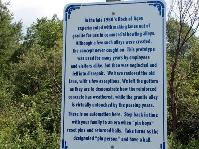
In the late 1950’s Rock of Ages experimented with making lanes out of granite...
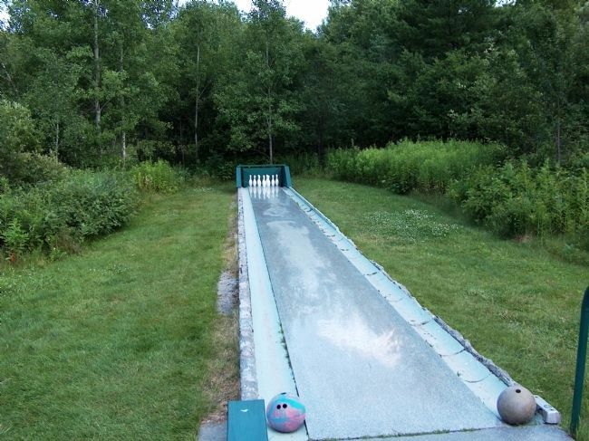
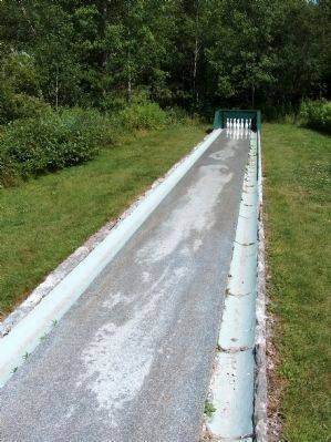
In the late 1950’s Rock of Ages experimented with making lanes out of granite for use in commercial bowling alleys. Although a few such alleys were created, the concept never caught on. This prototype was used for many years by employees and visitors alike, but then was neglected and fell into disrepair. We have restored the old lane, with a few exceptions. We left the gutters as they are to demonstrate how the reinforced concrete has weathered, while the granite alley is virtually untouched by the passing years. There is no automation here. Step back in time with your family to an era when “pin boys” reset pins and returned balls. Take turns as the designated “pin person” and have a ball.
Erected by Rock of Ages Granite Quarry.
Topics. This historical marker is listed in these topic lists: Industry & Commerce • Sports.
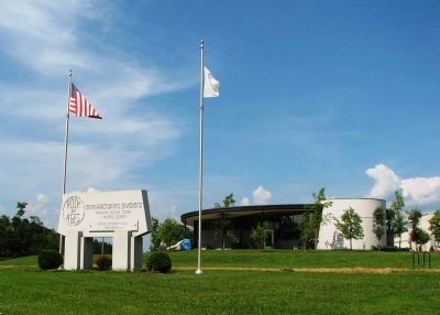
Location. 44° 9.307′ N, 72° 29.495′ W. Marker is in Graniteville, Vermont, in Washington County. Marker can be reached from Graniteville Road. Marker is located beside the subject granite bowling alley, on the grassy knoll along the south side of the Rock of Ages Quarry visitor center. Touch for map. Marker is at or near this postal address: 558 Graniteville Road, Graniteville VT 05654, United States of America. Touch for directions.
Other nearby markers. At least 8 other markers are within 5 miles of this marker, measured as the crow flies. Historic Millstone Hill (approx. 1.9 miles away); Currier Park (approx. 2.9 miles away); First Boy Scout Troop in America (approx. 3.1 miles away); Thomas Davenport (approx. 3.3 miles away); Davenport Birthplace (approx. 3.4 miles away); Town of Williamstown (approx. 3.4 miles away); Washington Vermont War Memorial (approx. 4.4 miles away); Washington Civil War Memorial (approx. 4.4 miles away).
Regarding In the late 1950’s Rock of Ages experimented with making lanes out of granite....
George B. Milne, one of the three founders of Rock of Ages, opened his first granite manufacturing business in 1885. During the last decade of the nineteenth century he had several short-lived partnerships. In 1905, he joined forces with quarry owners James Boutwell and Harvey Varnum, forming Boutwell, Milne & Varnum Company ("BM&V").
Also see . . .
1. Rock of Ages Granite Quarry. Quarry website homepage (Submitted on March 8, 2015, by Cosmos Mariner of Cape Canaveral, Florida.)
2. Smith Granite Quarry. The Center for Land Use Interpretation website entry:
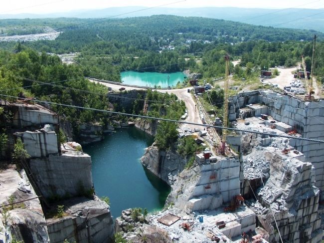
The Upper E. L. Smith Quarry is said to be the "largest and deepest dimension granite quarry in the world." It is one of several in the region, most of which are owned and operated by the Rock of Ages company. The grey granite of the Graniteville quarries is popular, especially for cemetery memorials, and that is the main business of nearby Barre. (Submitted on March 8, 2015, by Cosmos Mariner of Cape Canaveral, Florida.)
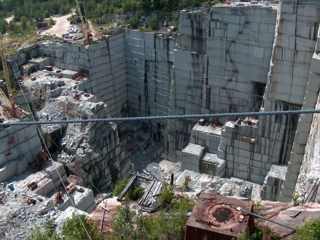
Photographed By Cosmos Mariner, July 14, 2006
5. Upper E. L. Smith Quarry (deep view)
The Upper E. L. Smith Quarry, at 600 feet deep, is said to be the "largest and deepest dimension granite quarry in the world." It is one of several in the region, most of which are owned and operated by the Rock of Ages company. The grey granite of the Graniteville quarries is popular, especially for cemetery memorials. This quarry rests atop a granite vein 6 miles long, 4 miles wide and 10 miles deep.
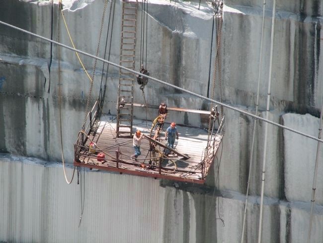
Photographed By Cosmos Mariner, July 14, 2006
7. Upper E. L. Smith Quarry (working detail)
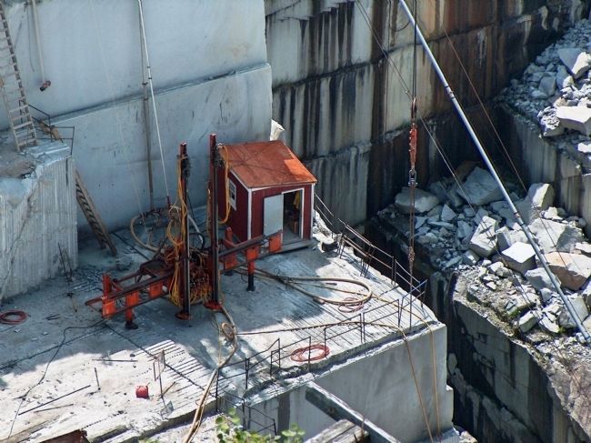
Granite was originally quarried using primitive techniques which implemented hand saws and explosive charges to blast away the "benches" of the quarry. Modern techniques have evolved to include diamond-tipped wire saws and water jets.
Credits. This page was last revised on February 16, 2023. It was originally submitted on March 7, 2015, by Cosmos Mariner of Cape Canaveral, Florida. This page has been viewed 802 times since then and 24 times this year. Photos: 1, 2, 3. submitted on March 7, 2015, by Cosmos Mariner of Cape Canaveral, Florida. 4, 5, 6, 7, 8, 9, 10. submitted on March 8, 2015, by Cosmos Mariner of Cape Canaveral, Florida. • Bill Pfingsten was the editor who published this page.
