Hermitage in Davidson County, Tennessee — The American South (East South Central)
The Hermitage Landscape
1804-1821
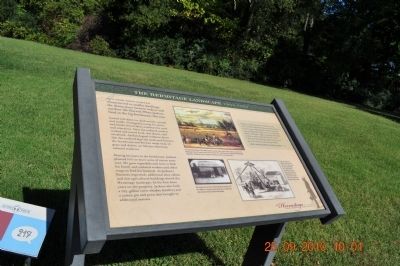
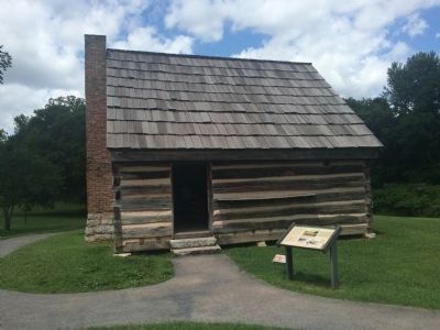
During his years in the farmhouse, Jackson planted 100 or more acres of cotton every year. He grew vegetables and corn to feed his family and enslaved workers and other crops to feed the livestock. As Jackson’s finances improved, additional slave cabins and new agricultural building dotted the Hermitage landscape. In his first three years on the property, Jackson also built a 125-gallon corn-whiskey distillery and a cotton gin and press that brought in additional income.
Topics. This historical marker is listed in these topic lists: African Americans • Agriculture.
Location. 36° 13.016′ N, 86° 36.672′ W. Marker is in Hermitage, Tennessee, in Davidson County. Marker can be reached from Rachel's Lane. Located at the Hermitage historical site. Touch for map. Marker is in this post office area: Hermitage TN 37076, United States of America. Touch for directions.
Other nearby markers. At least 8 other markers are within walking distance of this marker. A home for Jackson’s Slaves (a few steps from this marker); A Future President's Home (a few steps from this marker); Abandonment and Preservation (a few steps from this marker); The Belted Galloway (within shouting distance of this marker); The First Hermitage (within shouting distance of this marker); Land Conservation at The Hermitage (within shouting distance of this marker); Field Quarter Trail (within shouting distance of this marker); Growing Cotton (within shouting distance of this marker). Touch for a list and map of all markers in Hermitage.

Photographed By Sandra Hughes, September 25, 2010
2. The Hermitage Landscape 1804-1821
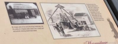
No images exist of the early Hermitage landscape, but this photo of a Virginia cabin shows how a swept yard and outside shelving would have looked.
No picture exist of the cotton gin Jackson built in 1807 and it is likely his gin and press went through two or three different incarnations. This print shows, a typical press for baling cotton and a gin house where the cotton seeds were removed and processed cotton stored.

Photographed By Sandra Hughes, September 25, 2010
3. The Hermitage Landscape 1804-1821
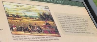
This painting by William Aiken Walker depicts enslaved cotton pickers. When Jackson purchased The Hermitage, trees still covered much of the land. By 1821, agricultural fields dominated The Hermitage landscape, coming very close to Jackson’s farmhouse, kitchen, and slave cabins.
I wish you to say to my overseer, that I am on my return, and will expect that my house will be prepared in such a way as will prevent the northern blast from entering. Say further to him, to have as much hemp broke as will make a sufficient quantity of Bailing to Bale my cotton and set wenches to spin it.
I shall want my Cotton for market on my arrival, say to the overseer to have the gin started.
-Andrew Jackson on Hermitage Operations, December 31, 1815
Credits. This page was last revised on February 7, 2023. It was originally submitted on February 10, 2012, by Sandra Hughes Tidwell of Killen, Alabama, USA. This page has been viewed 566 times since then and 7 times this year. Last updated on March 13, 2015, by J. Makali Bruton of Accra, Ghana. Photos: 1, 2, 3. submitted on February 10, 2012, by Sandra Hughes Tidwell of Killen, Alabama, USA. 4. submitted on July 12, 2015, by J. Makali Bruton of Accra, Ghana. • Bill Pfingsten was the editor who published this page.

